What is recorded here
No map has ever marked the oval rath at the north end of the Mayo ridge, yet its bank still cuts the slope like a forgotten knife. Local tradition claims an underground passage waits beneath the grass, inviting curiosity into darkness that may swallow more than light. The missing chart line does not diminish the place; it reserves the fort for people willing to trust what the soil remembers.
In pasture, located at the N end of a low, roughly N–S ridge, utilising the natural fall of ground to N and W. Good views over rolling pasture, with expanses of bog to E–SE.
Not indicated on any edition of the OS 6-inch maps. Slightly raised oval area (48.5m N–S; 56.5m E–W) defined SSW–NNE by a levelled bank surviving as a low scarp (Wth slope 2m at W, 4.5m at N; H 0.7m at W, 1.6m at N); it is best preserved on the NW arc where it is cut into the natural slope. Elsewhere the scarp can be traced only as a slight rise/undulation. A short section (L 8m) of the scarp at N has been dug away.
The level, grassy interior is crossed roughly centrally, on an ENE–WSW axis, by remnants of a field bank, now topped with a post and wire fence. A field wall on a NW–SE axis overlies the E edge of the rath. According to local tradition, there is a Man-made underground passage (MA093-097002-) in the rath.
Compiled by: Jane O’Shaughnessy
Date of upload: 30 June 2022
The monument record does not grant public access. Check the route and ask the landowner before entering private land.
- What survives
- Recorded monument
Places near here
 IndicatedFairy fort / earthen ringfort · 781 yd
 Enclosure in KilmanninEnclosure · 987 yd
 Ballyhaunis Courthousecourt house · 1.1 mi
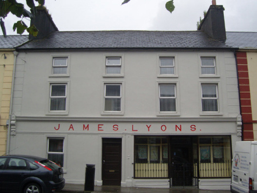 James Lyonshotel · 1.1 mi
 CastleCastle, unclassified · 1.9 mi
 Rath Castle in ruinsCastle, tower house · 4.9 mi
 East Mayo Brigade MonumentMemorial · 6.8 mi
 Kiltimagh MuseumMuseum · 11 mi
 Land of the GiantsHeritage attraction · 11 mi
 Oak WoodForest · 11 mi
 I'll Send You The FareMemorial · 11 mi
 Geoffrey's WoodForest · 12 mi