
What is recorded here
The fairy fort or earthen ringfort in Castletown Lower is in County Westmeath, Ireland. It sits atop a low natural hillock 130 metres east of Castletown Cottage and was annotated as a fort on the 1837 Ordnance Survey Fair Plan map. The surviving remains are a natural oval-shaped hillock measuring approximately 26 metres east-west and 20 metres north-south, with its base revetted by a low modern dry-stone wall. The hill has been planted with trees and appears as a post-1700 designed landscape feature associated with the nearby cottage, possibly a ringfort modified as a tree-ring during that period.
Situated atop low natural hillock 130m E of Castletown Cottage. Annotated 'Fort' on the 1837 OS Fair Plan map. Present remains consist of a natural oval-shaped hillock (approx. dims. 26m E-W; 20m N-S) the base of which is revetted by a low modern dry-stone wall. The low hill has been planted with trees and has the appearance of a post-1700 designed landscape feature associated with nearby Castletown Cottage. Possibly a ringfort modified as a tree-ring in the post 1700 period.
Compiled by: Frank Coyne and Caimin O'Brien
Date of upload: 15 November 2016
The monument record does not grant public access. Check the route and ask the landowner before entering private land.
- What survives
- Recorded monument
Places near here
 Castletown Houseworker's house · 156 yd
 CastleCastle, motte · 277 yd
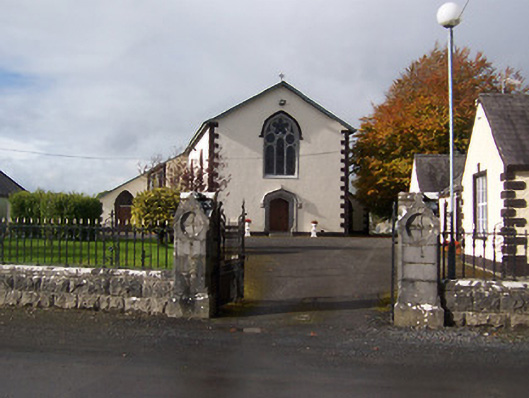 Saint Michael's Catholic Churchchurch/chapel · 694 yd
 Site of CastleCastle, unclassified · 863 yd
 HacuredFairy fort / earthen ringfort · 1302 yd
 Enclosure in FoyranEnclosure · 1.3 mi
 MullaghmeenMountain / peak · 1.7 mi
 Mullaghmeen White WalkWalking route · 1.9 mi
 Rock of CurryCliff · 1.9 mi
 Mullaghmeen Red WalkWalking route · 2.1 mi
 Fox CovertForest · 2.3 mi
 Mullaghmeen ForestPicnic place · 2.5 mi
Other information
Photo: Credit not shown in the picture search · Rights wording not checked; contact us if this picture should be removed