What is recorded here
Enclosure in Cappanahanagh stands as a low oval earthwork beside a glacial pond, its northern half flattened when farm boundaries cut through the ancient circle. The surviving southern curve still faces Limerick City, suggesting the site was built to be seen rather than hidden. Cattle may have trod the rest away, yet the shape endures in soil and memory.
On rolling pasture on the SW of Boarmanshill on a low knoll on the immediate SW side of a pond in a glacial hollow with a view over Limerick City. A well annotated ‘Toberaguile’ is located 180m to the SW, a possible hilltop enclosure or royal fort of Lisgorey (LI007-002----) is located 850m to N, with a smaller ringfort (LI007-003----) 500m NNE. Depicted on 1840 ed. OS 6-inch map as a circular enclosure. The site description is based upon the 1897 OS 25-inch map which shows that the monument was incorporated into field boundaries with the levelling of the northern half of the earthwork. The enclosure is oval (dims. c. 27m NW-SE x 22m NE-SW). Visible as a low relief earthwork on Digital Globe orthophotos taken 2011-13 and as a cropmark on Google Earth orthoimage taken 28/06/2018.
See attached Google Earth orthophoto
Compiled by: Edmond O’Donovan
Date of upload: 23 July 2020
The monument record does not grant public access. Check the route and ask the landowner before entering private land.
- What survives
- Recorded monument
Places near here
 Glenstal Abbeygate lodge · 1137 yd
 Killeen Burial GroundChildren's burial ground · 1193 yd
 Settlement desertedSettlement deserted, medieval · 1457 yd
 IndicatedCastle, unclassified · 1462 yd
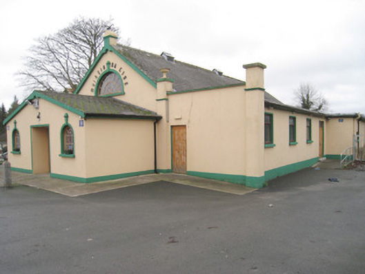 Moroe Muintir na Tíre Hallcommunity centre · 1532 yd
 Sliev Felim WayVisitor information · 1.1 mi
 Graveyard in AbingtonGraveyard · 2.2 mi
 Bawn in RathBawn · 2.8 mi
 Slieve Felim WayWalking route · 3.4 mi
 Slieve FelimMountain / peak · 4.3 mi
 KnockseefinMountain / peak · 7.4 mi
 The Pollagh TrailNature reserve · 7.6 mi