What is recorded here
Fairy fort / ringfort in Ballyvoyle is a fairy fort or ringfort in Ballyvoyle, County Waterford, Ireland. It occupies a hilltop pasture overlooking the mouth of the Dalligan River and the sea. A trapezoidal field measured about 80 metres from northeast to southwest and 50 to 120 metres from northwest to southeast was known locally as the Old Fort in the 1930s, although nothing is visible at ground level.
Situated in pasture on a hilltop overlooking the mouth of the N-S Dalligan River, c. 400m to the W and the sea c. 300m to the SW. A trapezoidal field (dims. c. 80m NE-SW; c. 50-120m NW-SE) was known locally in the 1930s as ‘the Old Fort’ (NMI file). Nothing is visible at ground level. Cairn (WA032-023----) is c. 160m to the WNW.
The above description is derived from the published 'Archaeological Inventory of County Waterford' (Dublin: Stationery Office, 1999). In certain instances the entries have been revised and updated in the light of recent research.
Compiled by: Michael Moore.
Date of upload/revision: 27th September 2011.
The monument record does not grant public access. Check the route and ask the landowner before entering private land.
- What survives
- Recorded monument
Places near here
 CairnCairn, unclassified · 334 yd
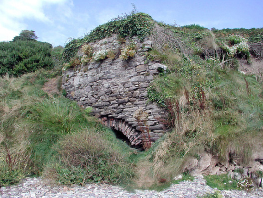 Historic buildingOfficially recorded historic building · 421 yd
 Ballyvoyle BridgeOfficially recorded historic building · 465 yd
 Grange WellSpring · 584 yd
 Burial in BallyvoyleBurial · 1090 yd
 Clonea StrandBeach / strand · 1.8 mi
 Site of CastleCastle, unclassified · 1.9 mi
 Bawn in Castlequarter (decies Without Drum By., Kilrossanty Par.)Bawn · 2.0 mi
 Stradbally CoveBeach / strand · 2.2 mi
 Stradbally Geological SundialHeritage attraction · 2.4 mi
 Horse-chestnutHorse-chestnut · 3.7 mi
 Ceann HeilbhicHeadland · 4.0 mi