
What is recorded here
Mount Ash is a circular castle mound in County Louth, Ireland, with a wide fosse and outer bank. Its centre has been quarried, but stone facing still shows on the south side. Two underground passages lie near the west, and old excavations found pottery and a bronze spur. The mound remains a visible marker of local defence and later reuse.
A roughly circular mound (max. diam. c. 51m at base, c. 29m at top, H 5.8m-6.8m) with remains of fosse (max. Wth at top 11.5m, Wth at base 2m) all around. There is a large bank (Wth c. 3.7m originally, now max. Wth 7.2m) outside the fosse from NE-NW. The surface of the top of the mound is uneven and slopes downwards towards the centre where it has been quarried. Stone facing can be seen in the S face of the mound in its mid section. The outside of the bank is faced with drystone work, probably modern, which extends across the fosse at the W and NE sides of the mound and forms a facing to the base of the motte where the bank is absent. The site was partially excavated in 1872 (Reade 1875, 322), and pottery and a bronze prick spur were found near the base of the mound. A Man-made underground passage (LH006-073002-) is situated in the W portion of the motte and another (LH006-072----) is c. 50m to the W. (Orpen 1908, 254-5; M W 1908, 85; Wright 1758, bk I, pl. VI)
The above description is derived from both the published 'Archaeological Inventory of County Louth' (Dublin: Stationery Office, 1986) and the 'Archaeological Survey of County Louth' (Dublin: Stationery Office, 1991). In certain instances the entries have been revised and updated in the light of recent research.
Date of upload: 17 July 2007
The monument record does not grant public access. Check the route and ask the landowner before entering private land.
- What survives
- Recorded monument
Places near here
 Man-made underground passage in Ash BigMan-made underground passage · 103 yd
 IndicatedMan-made underground passage · 675 yd
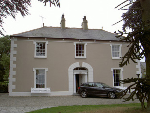 Killycroney Househouse · 1326 yd
 Killycroney Bridgebridge · 1356 yd
 CastleCastle, motte and bailey · 1.1 mi
 Castletown MotteArchaeological place · 3.8 mi
 Photo GalleryHeritage attraction · 4.2 mi
 Dundalk CentralHeritage attraction · 4.2 mi
 Maid of ErinMemorial · 4.6 mi
 Bombing 1975Memorial · 4.7 mi
 Sky HillMountain / peak · 5.1 mi
 Ballsmill Amenity LandPicnic place · 5.5 mi
Other information
Photo: Credit not shown · Copyright shown; no reuse licence shown