What is recorded here
Kildromalive holds three leaning stones and a buried recumbant on a narrow pasture slope above Adrigole Harbour. They form an open trapezoid beside a circular enclosure, not a polished chamber or a grand alignment. The east stone bends westward as if listening to the valley, while the recumbant half disappears into earth, perhaps never fully placed at all.
Level platform in pasture, on NW-facing slope of narrow valley running N from Adrigole Harbour into Caha Mountains. Circular enclosure (CO103-00701-) c. 20m to WSW. Three very roughly shaped standing stones and recumbent stone placed in trapezoidal position. Stones to W (H 0.95m; 1.3mx 0.55m) and N (H 0.9m; 1.1m x 0.45m) upright; E stone (H 1.6m; 1.6m x 0.3m) leans heavily to W. Recumbent stone (L 2.2m; 0.6m x 0.6m) partially buried; could be natural outcrop. Platform boulded to NW by line of overgrown boulders, rough walling or field clearance.
The above description is derived from the published 'Archaeological Inventory of County Cork. Volume 1: West Cork' (Dublin: Stationery Office, 1992). In certain instances the entries have been revised and updated in the light of recent research.
Date of upload/revision: 14 January 2009
The monument record does not grant public access. Check the route and ask the landowner before entering private land.
- What survives
- Recorded monument
Places near here
 Mass MountMountain / peak · 499 yd
 Stone CircleHut site · 737 yd
 Kilcaskan Church (in Ruins)Church · 1170 yd
 Boulder-burial in Cappaleigh NorthBoulder-burial · 1196 yd
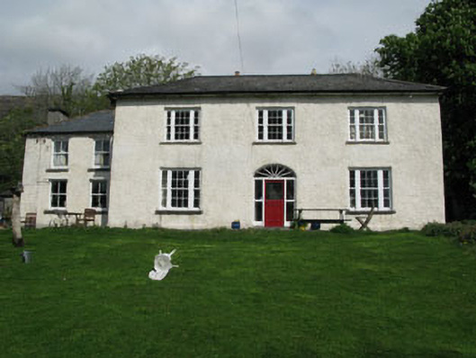 Adrigole Houserectory/glebe/vicarage/curate's house · 1741 yd
 Hungry Hill GalleryGallery · 1.1 mi
 West Cork Sailing & Powerboating CentreHeritage attraction · 1.3 mi
 Graveyard in DrumlaveGraveyard · 1.4 mi
 Adrigole MountainMountain / peak · 1.4 mi
 Orthon's IslandIslet · 1.5 mi
 Shot HeadHeadland · 2.4 mi
 Mehal HeadHeadland · 2.9 mi