
What is recorded here
From OpenStreetMap (© OpenStreetMap contributors) w1208118685
Places near here
Photo credits
- Sitomon, Wikimedia Commons · CC BY-SA 2.0
- Wanfried-Dublin, Wikimedia Commons · CC BY-SA 4.0
- Maker not stated on source page, www.pinterest.com
- Maker not stated on source page, www.gaia.com
- Maker not stated on source page, tr.pinterest.com
- Kieran Campbell, Geograph · Creative Commons Attribution-ShareAlike 2.0
- Maker not stated on source page, www.dreamstime.com
- Maker not stated on source page, en.wikipedia.org
- HoganStand; individual photographer not stated on source page, hoganstand.com
- Kmcnamee, Wikimedia Commons · CC BY-SA 4.0
- Olivier BEZES, Wikimedia Commons · CC BY 2.5
 European Yew219 yd
Explorer Tom If this European Yew were at a wedding, it would be the uncle who stands in the corner judging everyone’s outfit. It’s…
 Druids AltarPortal tomb · 429 yd
Explorer Tom Druids Altar in Rathkenny hosted a fiddler who played all night without stopping. The music was so good the stones…
 CastleHouse, 16th/17th century · 1416 yd
Explorer Tom Castle in Rathkenny thinks tourists from Dublin are just noisy pigeons who don’t know how to appreciate a proper tower…
 Fairy fort / earthen ringfort in RathkennyFairy fort / earthen ringfort · 1443 yd
Explorer Tom Fairy fort / earthen ringfort in Rathkenny would tell you it’s a cozy little circle that loves water-logged ditches.…
 Bullaun stone in KnockBullaun stone · 1619 yd
Explorer Tom Bullaun stone in Knock sits right beside a high cross head, looking distinctly unimpressed with its own popularity. If…
 Grave YardGraveyard · 1634 yd
Explorer Tom Graveyard in Knock wants a New Year’s resolution: to stop being so rectangularly boring and start acting mysterious…
 Mapped cemeteryCemetery · 1634 yd
Explorer Tom This particular Mapped Cemetery is in a heated argument with the nearest tree, who refuses to stop leaning over the…
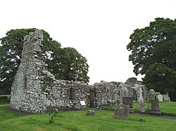 Site of Old ChurchChurch · 1.0 mi
Explorer Tom Site of Old Church in Rathkenny is just a rise now, but it used to have a vicar named John Tyrrell. Imagine him posting…
 St. Mary's ChurchRuins · 1.1 mi
Explorer Tom St. Mary's Church in County Meath has a ghost who is far too lazy to actually haunt the place, preferring to nap in the…
 Castletown GAA pitchGAA ground · 1.4 mi
 Rathkenny GAAGAA ground · 2.1 mi
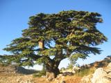 Lebanon Cedar2.3 mi
Explorer Tom This Lebanon Cedar has an ongoing feud with the rain, complaining that it gets in its hair too much. It’s dramatic…
More archaeology and monuments in County Meath · All of County Meath

What do you know about this place?Tap to add a comment or ask a question