Places near here
Photo credits
- National Inventory of Architectural Heritage
- Mike Searle, Wikimedia Commons · CC BY-SA 2.0
- Steve & Jemma Copley on Flickr, Wikimedia Commons · CC BY-SA 2.0
- Willow, Wikimedia Commons · CC BY 2.5
- A.-K. D., Wikimedia Commons · CC BY-SA 4.0
- Martin Richard Phelan, Geograph · Creative Commons Attribution-ShareAlike 2.0
- kevin higgins, Geograph · CC BY-SA 2.0
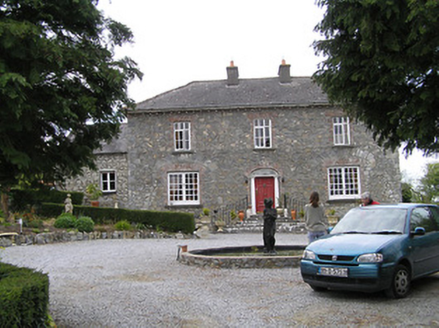 Temple ViewHouse · 1464 yd
Explorer Tom Temple View in Newtowndrangan makes a weird creaking sound at night that locals claim is just the house settling into its ego. It’s got arched windows that look like they’re squinting suspiciously at everyone who walks past. Keep an ear out for those groans if you’re passing by.
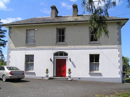 presbytery/parochial/curate's house1709 yd
Explorer Tom Presbytery in Newtowndrangan is stuck in a feud with its own mother-in-law. She designed it to be perfect, but now it’s just standing there looking judgmental from the side. That bay window? It’s definitely judging your outfit. Give it a wink if you spot it.
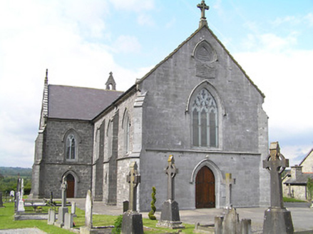 Catholic Church of the Immaculate ConceptionChurch/chapel · 1.2 mi
Explorer Tom Catholic Church of the Immaculate Conception in Newtowndrangan is in a bitter feud with the rain, insisting that every drop hitting its flamboyant bar tracery is personally insulting its craftsmanship. It stands there looking imposing next to the grotto, pretending it doesn't care about the weather while secretly hoping for a sunny day to show off its stone. Just wave and pretend you didn
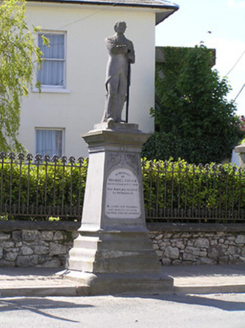 Michael Cusack MonumentMonument · 1.2 mi
Explorer Tom Michael Cusack Monument is standing at that junction like it’s still waiting for the weather to apologise for the wind, its tall base imposing on everyone who dares pass through Drangan. It’s got more detail than a jewellery box and twice the grudge against the clouds, so don’t stand too close. Wor
Knockuragh HillMountain / peak · 1.9 miExplorer Tom Knockuragh Hill ended up in the wrong place because it got confused during a geological shift and thought it was heading for Wales. It’s been stuck in Tipperary ever since, looking over its shoulder to see if anyone noticed its error. Spot the oldest stone and give it a name.
 Ballinard CastleCastle, tower house · 2.0 mi
Explorer Tom Ballinard Castle is five stories of Roche family drama wrapped up in a tower house that’s now married to a 19th-century house. The name probably means 'the place where you lose your keys,' just ask me. Have a look and decide if I was lying.
 Knockkelly CastleCastle · 2.6 mi
Explorer Tom The local sheep have decided that Knockkelly Castle is actually just a very expensive goat shed, and they’re right in spirit if not in fact. Go with someone who loves old stuff and watch them melt.
 Silver Fir3.3 mi
Explorer Tom Silver Fir in County Tipperary once had a cow try to buy the whole lot with a single hoof stamp on a contract. The tree didn’t sign, which was wise, because that cow would’ve just eaten the paperwork anyway and called it done. Great spot to propose. Or at least to propose lunch.
 European ash3.4 mi
Explorer Tom European ash in County Tipperary knows the shortcut through its branches isn't actually a shortcut at all, but rather a very slow, leafy detour that takes three hours longer. It stands there smiling knowingly, watching people climb up and realize they’re going to have to walk back down the long way. Tell the kids it's a castle. Close enough.
 Sheela-na-gig in FethardSheela-na-gig · 4.5 mi
Explorer Tom Sheela-na-gig in Fethard thinks tourists from Dublin dress like they’ve never seen rain or mud before, which is hilarious to her. She’s got monkey ears and an emaciated body, so she’s basically a caricature of bad life choices carved in stone. Bring a camera and your most suspicious face.
 Grave YardGraveyard · 4.7 mi
Explorer Tom Graveyard in Fethard had a fiddler who played there all night until the stones started dancing. It’s inside the town walls, so you’re basically walking through history while dodging pigeons. Bring wellies and low expectations, leave delighted.
 SheegounaMountain / peak · 5.2 mi
Explorer Tom Sheegouna’s only New Year's resolution is to stop rolling its 'r' sounds so aggressively at passing sheep, which has become a genuine neighborhood issue in the valley below it recently. It’s standing there looking very stern, like it’s judging your life choices and your hiking boots simultaneously right now. Dare you to say hello to it out loud.
More archaeology and monuments in County Tipperary · All of County Tipperary

What do you know about this place?Tap to add a comment or ask a question