What is recorded here
The Urban Survey of Limerick recorded the following details about the Rath of Rathkeale; 'Located on a hill at the south end of the town. It appears as a natural knoll c.2m higher that the sub-rectangular field in which it is situated. It measures 40m east-west by 32m
north-south and the ground slopes away gradually on all sides' (Bradley et. al. 1989, 224-5). Outline of enclosure not visible today on Digital Globe aerial photography.
The Urban Survey of Limerick recorded the following details about the Rath of Rathkeale; 'Located on a hill at the south end of the town. It appears as a natural knoll c.2m higher that the sub-rectangular field in which it is situated. It measures 40m east-west by 32m north-south and the ground slopes away gradually on all sides' (Bradley et. al. 1989, 224-5). Outline of enclosure not visible today on Digital…
From the National Monuments Service (Archaeological Survey of Ireland) record LI029-031007
The monument record does not grant public access. Check the route and ask the landowner before entering private land.
- What survives
- Recorded monument
Places near here
Photo credits
- National Inventory of Architectural Heritage
- Mike Searle, Geograph · CC BY-SA 2.0
- Willow, Wikimedia Commons · CC BY 2.5
- Created by Kglavin Modified Aug 2007 by Mike Christie, Wikimedia Commons · CC BY-SA 3.0
- Roger McLachlan, Wikimedia Commons · CC BY-SA 2.0
- Vadim Manuylov, Wikimedia Commons · CC BY-SA 3.0
- A.-K. D., Wikimedia Commons · CC BY-SA 4.0
 Mount SouthwellCountry house · 127 yd
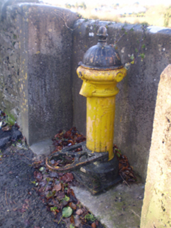 water pump173 yd
 Holy Trinity Church (Rathkeale)Mausoleum · 212 ydGrave YardGraveyard · 221 yd
 Castle MatrixCastle, tower house · 834 yd
 Castle MatrixCastle · 845 ydTobernablahySpring · 1.4 mi
 European ash2.1 mi
 Ardagh FortArchaeological place · 5.4 mi
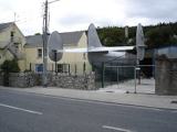 Foynes Flying Boat & Maritime MuseumMuseum · 9.5 mi
 Monterey Cypress11 mi
 Saint Ite's WellSpring · 11 mi
More archaeology and monuments in County Limerick · All of County Limerick
What do you know about this place?