What is recorded here
The medieval church ruins (LI029-031004-) of Rathkeale dedicated to the Holy Trinity lie 10 metres S of the 19th century C. of I. church both of which stand in the N quadrant of a square-shaped graveyard (approx. dims. 78m E-W x 79m N-S) enclosed by a post-1700 stone wall with entrance gate at centre of N wall. Architectural fragments from the medieval church ruins have been reused as graveyard markers visible in the SW corner of the graveyard (Bradley et. al. 1989, 221-2).
The medieval church ruins (LI029-031004-) of Rathkeale dedicated to the Holy Trinity lie 10 metres S of the 19th century C. of I. church both of which stand in the N quadrant of a square-shaped graveyard (approx. dims. 78m E-W x 79m N-S) enclosed by a post-1700 stone wall with entrance gate at centre of N wall. Architectural fragments from the medieval church ruins have been reused as graveyard markers visible in…
From the National Monuments Service (Archaeological Survey of Ireland) record LI029-031005
The monument record does not grant public access. Check the route and ask the landowner before entering private land.
- What survives
- Recorded monument
Places near here
Photo credits
- National Inventory of Architectural Heritage
- Mike Searle, Geograph · CC BY-SA 2.0
- Willow, Wikimedia Commons · CC BY 2.5
- Created by Kglavin Modified Aug 2007 by Mike Christie, Wikimedia Commons · CC BY-SA 3.0
- Roger McLachlan, Wikimedia Commons · CC BY-SA 2.0
- Vadim Manuylov, Wikimedia Commons · CC BY-SA 3.0
- A.-K. D., Wikimedia Commons · CC BY-SA 4.0
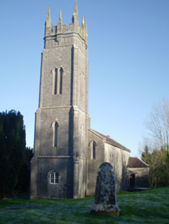 Holy Trinity Church (Rathkeale)Church/chapel · 30 yd
 Holy Trinity Church (Rathkeale)Mausoleum · 45 yd
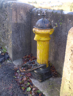 water pump121 ydRathkealeFairy fort / earthen ringfort · 221 yd
 Castle MatrixCastle, tower house · 858 yd
 Castle MatrixCastle · 869 ydTobernablahySpring · 1.5 mi
 European ash2.3 mi
 Ardagh FortArchaeological place · 5.5 mi
 Foynes Flying Boat & Maritime MuseumMuseum · 9.5 mi
 Monterey Cypress11 mi
 Saint Ite's WellSpring · 11 mi
More archaeology and monuments in County Limerick · All of County Limerick
What do you know about this place?