What is recorded here
Rathcallaun is a grassy fairy fort standing eighty feet wide in Limerick pasture, barely a hundred metres from the Tipperary border. It has watched cattle, rain and forgotten people for centuries while local residents forgot its name entirely. The mound does not need recognition to keep its shape or resist the plough.
In pasture, 100m N of County boundary with Tipperary. Annotated ‘Rathcallaun’ on OSi historic maps and depicted on the 1840 ed. OSi 6-inch map as a circular shaped area enclosed by a bank in the NE corner of a field. Shown on the 1897 ed. OSi 25-inch map as circular-shaped platform (diam. c. 18m) defined by a scarp, 11m N of a drainage channel running NE-SW. Described in 1960 as a; ‘Smooth-surfaced grassy mound 80 feet [24.3m] in diameter and 18 feet [5.5m] high. Faint traces of wide shallow ditch with wide outer bank on south and east sides. Map name of “Rathcallaun” not known locally’ (O’Dwyer 1958-61, 113; Gortakilleen 49). Monument consisting of a platform defined by a fosse is clearly visible on OSi orthophotograph taken between 2005-12 and on Google Earth orthoimage dated 18/11/2018.
See attached drawing by O’Dwyer and Google Earth orthoimage.
Compiled by: Fiona Rooney
Date of upload: 21 April 2021
The monument record does not grant public access. Check the route and ask the landowner before entering private land.
- What survives
- Recorded monument
Places near here
 BarrowBarrow, unclassified · 662 yd
 Enclosure in Milltown (cullen Par.)Enclosure · 765 yd
 RoadRoad, unclassified togher · 1072 yd
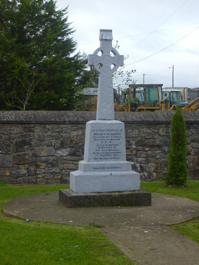 O'Donnell Monumentmonument · 1099 yd
 Site of Cullen CastleCastle, unclassified · 1210 yd
 Oola HillMountain / peak · 1288 yd
 CloghadaltonCastle, unclassified · 1456 yd
 ToberagaddySpring · 4.1 mi
 KnockseefinMountain / peak · 5.1 mi
 St. Patrick's WellSpring · 5.8 mi
 Flat cemetery in Knockainy WestFlat cemetery · 8.8 mi
 Grave YardGraveyard · 1151 yd