What is recorded here
In pasture, located on a rise, in gently undulating coastal terrain, overlooking an inlet in Killala Bay c. 150m to E.
This rath is named ‘Rathbeg’ on the 1838 and 1922 OS 6-inch map. It consists of a raised, roughly circular area (21m NW–SE; 20.5m NE–SW) defined at NE–E by remnants of a broadly slumped bank (Wth 5.6m; int. H 0.3m; ext. 1.45m) and elsewhere by an earthen scarp (H 1.2m at S; 0.5m at W), which is almost vertical and faced with stone at S–SW, and at W-N is very low and degraded. There is low section/break (Wth c. 3m) at S, but is unclear if this represents an original entrance. A field fence/property boundary, on NE–SW axis, bisects the interior to W of centre.
Appended to the S–SW end of the rath is a semi-circular terrace (17m NW–SE; 12.6m NE–SW), which is at a level c. 1m lower than the rath interior. It is defined at E–SW by a scarp, and is bordered at W by the field fence that bisects the rath.
There is a rath (MA015-050----) 130m to NNE and another rath (MA015-051----) 100m to ENE. Two other raths (MA015-053----; MA015-054----) are visible c. 300m to SE.
Compiled by: Jane O’Shaughnessy
Date of upload: 6 December 2018
The monument record does not grant public access. Check the route and ask the landowner before entering private land.
- What survives
- Recorded monument
Places near here
 IndicatedFairy fort / earthen ringfort · 135 yd
 RathmoreFairy fort / earthen ringfort · 172 yd
 Rinnaun PointHeadland · 748 yd
 Green IslandIslet · 967 yd
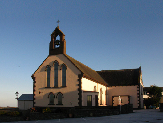 Saint Patrick's Catholic Churchchurch/chapel · 1134 yd
 The Old Deaneryrectory/glebe/vicarage/curate's house · 1324 yd
 Battle of Killalabattle · 1388 yd
 CastleCastle, unclassified · 1453 yd
 Bawn in Meelick (tirawley By.)Bawn · 1.4 mi
 Battlefields of MoyneBattlefield · 1.7 mi
 Bartragh IslandIsland · 2.2 mi
 Moyne AbbeyHeritage attraction · 2.2 mi