
What is recorded here
In grassland on poorly drained land on SE-facing slope of low rising ground with good extensive views in all directions, poorly drained land to S and E of enclosure. Large roughly circular area (int. diam. 102m N-S; 98m E-W) enclosed by an earth and stone bank (top Wth 2m; base Wth 8m; int. H 0.5-1.5m; ext. H 1-2m) best preserved from S through W to N and outer fosse (top Wth 4.5-6.5m; base Wth 1.4-3.5m; ext. D 0.3-0.7m) best preserved from W to N. Enclosing bank has been levelled from N to E and reduced to a scarp (H 1m) from E to S where field drain intersects outer face of scarp on a NE-SW axis. Gap in bank at NW (Wth 2.2m) may be just a livestock gap. Enclosing bank is best preserved on the upslope at W and the outer fosse is best preserved from NW to N. Internally the N quadrant of the interior is sub-divided by a low earthen bank which forms a small rectangular enclosure (int. dims. 40m N-S; 47m NW-SE ) enclosed by a poorly preserved earth and stone bank (top Wth 1.7m; base Wth 3.5m; int. H 0.2-0.7m; ext. H 0.3m) and outer fosse (top Wth 2.5m; base Wth 1.2m; ext. D 0.3m) which runs off inner face of enclosing bank of larger enclosure at NW and NE. Wide gap (wth 7m) in bank at SW appears to be a modern feature.
Compiled by: Jean Farrelly
Date of upload: 26 August 2011
The monument record does not grant public access. Check the route and ask the landowner before entering private land.
- What survives
- Recorded monument
Places near here
 IndicatedEnclosure · 879 yd
 Church (In Ruins)Church · 1289 yd
 ShaunafaurkEnclosure · 1572 yd
 CastleCastle, unclassified · 1.2 mi
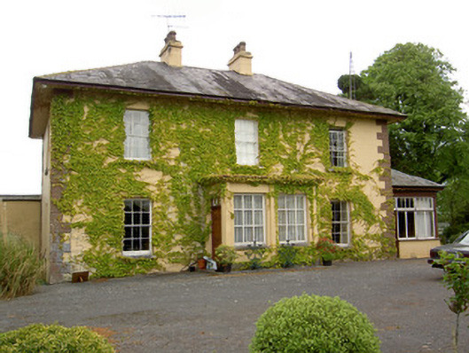 Ballymore Housecountry house · 1.2 mi
 Camus Castle (in ruins)Castle, unclassified · 1.6 mi
 European ashEuropean ash · 2.1 mi
 Hore AbbeyHeritage attraction · 3.6 mi
 Rock of CashelHeritage attraction · 3.7 mi
 The Rock Of CashelVisitor information · 3.8 mi
 Black mulberryBlack mulberry · 3.9 mi
 Soloheadbeg Ambushambush · 8.7 mi
Other information
Photo: Credit not shown in the picture search · Rights wording not checked; contact us if this picture should be removed