
What is recorded here
From the Northern Ireland Sites and Monuments Record record ANT044:070
Places near here
Photo credits
- Maker not stated on source page, esimplus.me
- Maker not stated on source page, ru.pinterest.com
- Maker not stated on source page, commons.wikimedia.org
- Maker not stated on source page, en.wikipedia.org
- Maker not stated on source page, www.youtube.com
- Golfing in Ireland; photographer not stated, Source publisher
- Maker not stated on source page, www.dreamstime.com
- Maker not stated on source page, www.flickr.com
- Kenneth Allen, Wikimedia Commons · CC BY-SA 2.0
- Albert Bridge, Geograph · CC BY-SA 2.0
- Otter, Wikimedia Commons
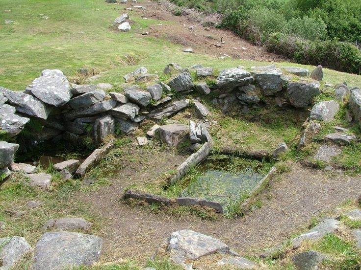 Burnt mound / fulacht fiadh in TullycreenaghtBurnt Mound / Fulacht Fiadh · 88 yd
Explorer Tom Burnt mound / fulacht fiadh in Tullycreenaght is basically ancient cooking equipment for people who really liked their…
 Church site in KilbegsChurch Site · 1.2 mi
Explorer Tom Church site in Kilbegs was designed by a mother-in-law who hated everyone's taste in altars. She made sure the…
 Cup-marked stone in LadyhillCup-marked Stone · 1.5 mi
Explorer Tom Cup-marked stone in Ladyhill has strict rules: no touching, no whispering, and definitely no wearing bright colors on a…
 Rath overlying neolithic occupation site in Shanes CastleRath overlying Neolithic Occupation Site · 1.5 mi
Explorer Tom Rath overlying neolithic occupation site in Shanes Castle has a rath on top of ancient people. It's like living with a…
 Ap Cropmark: Oval-shaped feature, possible enclosure? in KilbegsAp Cropmark: Oval-shaped feature, possible enclosure? · 1.5 mi
Explorer Tom Ap Cropmark: Oval-shaped feature, Possible enclosure? in Kilbegs has the confidence of an egg that hasn’t decided if…
 Megalithic tomb: the rock (unlocated) in Barnish (possible); Maghereagh (possible)Megalithic tomb: the rock (unlocated) · 1.6 mi
Explorer Tom Megalithic tomb: the rock in Barnish, Maghereagh gave up sugar for Lent but kept eating peat. It’s basically a giant…
 Antrim Golf ClubGolf course · 1.7 mi
 Graveyard: shilvodan or shilvodan old grave yard in DrumkeeranGraveyard: Shilvodan or Shilvodan Old Grave Yard · 1.9 mi
Explorer Tom Graveyard: shilvodan or shilvodan old graveyard in Drumkeeran is older than the road next to it. A poet fell in the…
 Village (unlocated) in Shanes Castle ParkVillage (unlocated) · 2.0 mi
Explorer Tom Village in Shanes Castle Park is having a massive row with the rain. It vanished so long ago it might be a rumour, but…
Shane's CastleRuins · 2.1 miExplorer Tom Shane's Castle has changed its name, lost buildings to fire and even tried running a railway. Show-off. It began in…
 Tower-house & later buildings : shane's castle (ruins) in Shanes Castle ParkTower-house & later buildings : shane's castle (ruins) · 2.1 mi
Explorer Tom Shane’s Castle in Shanes Castle Park is ruins, but it looks like it just stepped out for a smoke break. The tower-house…
 Antrim Round TowerHeritage attraction · 2.1 mi
Explorer Tom Antrim Round Tower rises beside Steeple Road like a stone exclamation mark that the town forgot to remove, though…
More archaeology and monuments in County Antrim · All of County Antrim

What do you know about this place?Tap to add a comment or ask a question