
What is recorded here
From the Northern Ireland Sites and Monuments Record record TYR034:026
Places near here
Photo credits
- Kenneth Allen, Wikimedia Commons · CC BY-SA 2.0
- Kenneth Allen, Geograph · Creative Commons Attribution-ShareAlike 2.0
- Maker not stated on source page, www.pinterest.com
- Maker not stated on source page, www.tripadvisor.ca
- Maker not stated on source page, en.wikipedia.org
- Maker not stated on source page, www.gettyimages.co.uk
- Maker not stated on source page, br.pinterest.com
- Kenneth Allen, commons.wikimedia.org
- Kenneth Allen, Geograph · CC BY-SA 2.0
- Golfing in Ireland; photographer not stated, Source publisher
 Dudgeon BridgeBridge · 1.4 mi
Explorer Tom Dudgeon Bridge was saved by a hero nobody remembers anymore, who probably just threw a really heavy rock at the problem…
 Platform rath in GillygoolyPlatform Rath · 1.5 mi
Explorer Tom Platform rath in Gillygooly survived for centuries despite the map makers drawing it as if it were a giant, confused…
 Graveyard: killymartin or kilmartin in GlasmullaghGraveyard: Killymartin or Kilmartin · 1.5 mi
Explorer Tom Graveyard: killymartin or kilmartin in Glasmullagh was once the site of such a massive argument that the whole parish…
 Kilmartin GraveyardGraveyard · 1.6 mi
Explorer Tom Kilmartin Graveyard in County Tyrone would be the awkward uncle at a wedding, standing by the cake table pretending to…
 Cairn?: carn hill in AghnamoyleCairn?: Carn Hill · 2.0 mi
Explorer Tom Cairn?: carn hill in Aghnamoyle is locked in an intense drama with the nearest tree, which it considers a rival for…
 Holy well (unlocated) in Tattykeel Buchannan or RodgersHoly well (unlocated) · 3.2 mi
Explorer Tom Holy well in Tattykeel Buchannan or Rodgers is currently unlocated, which means the local sheep have probably been…
 Court tomb: horned cairn in LeglandCourt Tomb: Horned Cairn · 3.2 mi
Explorer Tom Court tomb: horned cairn in Legland is sick of people asking if the horns are real; they’re just rocks shaped like cow…
 Holy well in CornabrackenHoly Well · 3.4 mi
Explorer Tom Holy well in Cornabracken holds a fake world record for the longest continuous sigh from a weary farmer. The water is…
 Clanabogan HouseHouse · 3.9 mi
Explorer Tom Clanabogan House is still upset about the day it was nearly sold for a horse because the paperwork got mixed up. It’s…
 Clanabogan, Sarsfield's GAA, DrumraghGAA ground · 4.0 mi
 Plantation Castle: Castle Curlews in KirlishPlantation Castle: Castle Curlews · 4.1 mi
Explorer Tom Plantation Castle: Castle Curlews in Kirlish has a fan club of one confused goose who thinks it's a duck pond. It’s a…
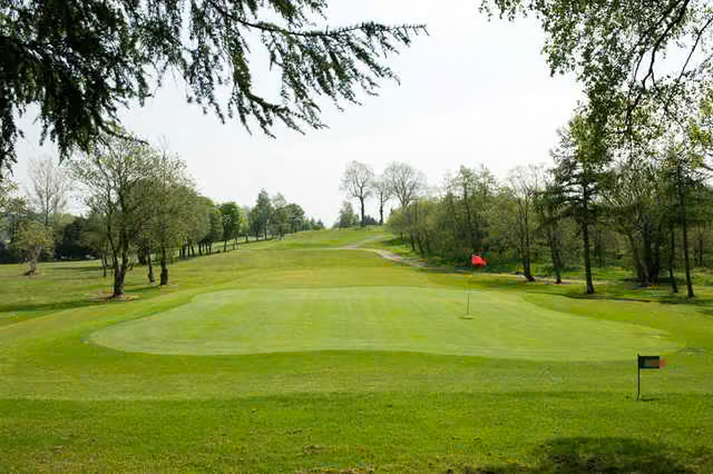 Omagh Golf ClubGolf course · 4.8 mi
More archaeology and monuments in County Tyrone · All of County Tyrone

What do you know about this place?Tap to add a comment or ask a question