
What is recorded here
From the Northern Ireland Sites and Monuments Record record TYR064:008
Places near here
Photo credits
- Maker not stated on source page, www.flickr.com
- Maker not stated on source page, www.geograph.ie
- Maker not stated on source page, za.pinterest.com
- Kenneth Allen, Wikimedia Commons · CC BY-SA 2.0
- Colin Park, Geograph · CC BY-SA 2.0
- Kenneth Allen, commons.wikimedia.org
- Willow, Wikimedia Commons · CC BY 2.5
- Maker not stated on source page, stock.adobe.com
- Maker not stated on source page, commons.wikimedia.org
- Hello, I am Bruce on Flickr, Wikimedia Commons · CC BY-SA 2.0
- National Inventory of Architectural Heritage
 Standing stone in KillStanding Stone · 1264 yd
Explorer Tom Standing stone in Kill has a very low opinion of tourists from Dublin and their questionable fashion choices. It thinks…
 Cairn in TireeghanCairn · 1.5 mi
Explorer Tom Cairn in Tireeghan is prehistoric and if it were a person at a wedding, it would be the uncle who stands in a corner…
 Graveyard in KillybaneGraveyard · 1.9 mi
Explorer Tom Graveyard in Killybane is where the ghosts went on strike for better coffee and never came back. It’s basically just…
 Methodist ChurchChurch · 2.9 mi
Explorer Tom Methodist Church in County Tyrone is in a constant battle with the rain because the weather keeps trying to get inside…
 Slieve BeaghMountain / peak · 3.3 mi
Explorer Tom Slieve Beagh can put one foot in Fermanagh, one in Tyrone and wave at Monaghan from the hollow. The broad upland…
 Slieve Beagh se TopMountain / peak · 3.7 mi
Explorer Tom Slieve Beagh SE Top has a long-standing grudge against the weather for constantly smudging its features like it’s a bad…
 St. Patrick's Park, Éire Óg GAA, ClogherGAA ground · 4.1 mi
 European ash4.6 mi
Explorer Tom European ash in County Fermanagh is probably judging your tree-climbing skills from up high. I heard it once told a bad…
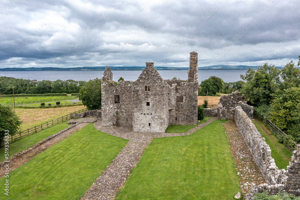 Castle: tullyweel house in TullyweelCastle: Tullyweel House · 4.8 mi
Explorer Tom Castle: Tullyweel house in Tullyweel will spill the beans after three pints, telling you it saw a bishop steal a sheep…
 Graveyard: kirk hill in KillarbranGraveyard: Kirk Hill · 5.0 mi
Explorer Tom Graveyard: Kirk Hill in Killarbran was once managed by a matchmaker who paired off headstones with nearby boulders. The…
 Scots Pine5.1 mi
Explorer Tom Scots Pine in County Fermanagh is standing there looking all stiff and proper, like a priest who lost a bet on the…
 Saint Joseph's Catholic ChurchChurch/chapel · 6.7 mi
Explorer Tom Saint Joseph's Catholic Church in Corlat has got a staircase tower that looks like it lost a fight with a rectangle.…
More archaeology and monuments in County Tyrone · All of County Tyrone

What do you know about this place?Tap to add a comment or ask a question