
Places near here
Photo credits
- Kenneth Allen, Wikimedia Commons · CC BY-SA 2.0
- Kenneth Allen, Geograph · CC BY-SA 2.0
- Kenneth Allen, Geograph · Creative Commons Attribution-ShareAlike 2.0
- Colin Park, Geograph · CC BY-SA 2.0
- Willow, Wikimedia Commons · CC BY 2.5
- R0025693, Wikimedia Commons · CC BY-SA 4.0
 Platform rath in FindermorePlatform Rath · 1.5 mi
Explorer Tom Platform rath in Findermore is so confident in its own muddy majesty that it refuses to acknowledge any car speeding past without at least a polite horn honk. It’s been sitting there judging drivers for centuries, mostly because they never stop to ask how its day is going. Take the long way round, it deserves the effort.
 Aughintain CastleRuins · 1.7 mi
Explorer Tom Aughintain Castle would thrive on a reality show because it knows exactly how to look dramatic when the camera crew arrives. It’s a ruin that performs its crumbling act for an audience of one very bored sheep nearby. Bring someone who'll believe anything.
 Holy Family rc ChurchStore · 1.7 mi
Explorer Tom Holy Family Rc Church in Syunshin has been turned into a store, which means there’s definitely a tunnel under the floor leading straight to the nearest pub for emergency exits. I’m quite sure the shelves are hiding more than just stock; they’re hiding secrets that would make your head spin. Have a look and decide if I was lying.
 C17th fortified house & bawn: aughentaine or aghintain castle in AghintainC17th Fortified House & Bawn: Aughentaine or Aghintain Castle · 1.7 mi
Explorer Tom Aughintain Castle is having a massive identity crisis between being Aghintain and just plain confused. If it walked into a chippy, I bet its last order was double chips with no ketchup because it feels too fancy for that. Stand there long enough and someone will ask if you're lost.
 Aughentaine Presbyterian ChurchChurch · 2.0 mi
Explorer Tom Aughentaine Presbyterian Church in County Tyrone was once ruled by a goat named Gerald who demanded the best seat and ate all the communion wafers without paying. He’s long gone now, but the church still keeps his favourite spot empty just in case he decides to return for a refund. If it's closed, admire it from the road like a polite stalker.
 Platform rath in TullanavertPlatform Rath · 2.0 mi
Explorer Tom Platform rath in Tullanavert would win a county fair by simply standing still on its ridge and letting people trip over themselves trying to get closer. It’s got that smug, elevated view over everything else, like it’s judging your life choices from above. Take a breath of that air, it's older than your car.
 Pre-norman cathedral; graveyard; augustinian friary; post-med. and modern cathedral; graveyard; 3 crosses; 2 bullauns: clogher cathedral or clochar or CLOCHAR-MAC-nDAIMENI in Clogher DemesnePre-norman Cathedral · 3.2 mi
Explorer Tom Clogher Cathedral would win any county fair because it has more history in one stone than your whole family tree combined. It’s basically a museum that forgot to put on the lights. Take a breath of that air, it's older than your car.
 "Fivemiletown Deli" G8 Virtual ShopHeritage attraction · 3.2 mi
Explorer Tom "Fivemiletown Deli" G8 Virtual Shop is basically a vacant building that has decided to be a deli in its dreams. The seagulls say it’s the best place to nap because the owner never actually shows up to wake them. Have a nosey, politely.
 Slieve BeaghMountain / peak · 3.6 mi
Explorer Tom Slieve Beagh is playing hard to get by straddling three counties in two hundred metres. It’s like the world’s most indecisive mountain, refusing to pick a side. Find the wonkiest bit and send it to your group chat.
 Slieve Beagh se TopMountain / peak · 3.9 mi
 European ash5.2 mi
Explorer Tom European ash in County Fermanagh is probably judging your tree-climbing skills from up high. I heard it once told a bad joke to a squirrel and didn't laugh. Visit, then text me what you think. I'll pretend to read it.
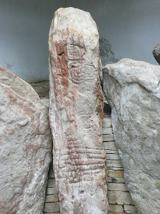 KnockmanyArchaeological place · 5.5 mi
Explorer Tom Knockmany is an archaeological shortcut that absolutely is not a shortcut, as I found out when my GPS decided to take a nap. The stones are arranged in a way that suggests they were just waiting for someone to trip over them and say something funny. Bring a jacket, it’s never as warm as I promise.
More archaeology and monuments in County Tyrone · All of County Tyrone

What do you know about this place?Tap to add a comment or ask a question