
What is recorded here
From the Northern Ireland Sites and Monuments Record record DOW051:013
Places near here
Photo credits
- Maker not stated on source page, www.tripadvisor.ru
- Maker not stated on source page, theintrepidtourist.blogspot.com
- Maker not stated on source page, www.dreamstime.com
- Maker not stated on source page, stlewis.co.uk
- Maker not stated on source page, en.wikipedia.org
- Eric Jones, Wikimedia Commons · CC BY-SA 2.0
- Eric Jones, Geograph · CC BY-SA 2.0
- Aubrey Dale, Wikimedia Commons · CC BY-SA 2.0
- Maker not stated on source page, www.belfastlive.co.uk
 Standing stone? in CarrogsStanding Stone? · 1379 yd
Explorer Tom Standing stone? in Carrogs is so suspicious of the postman that it refuses to acknowledge him unless he brings a very…
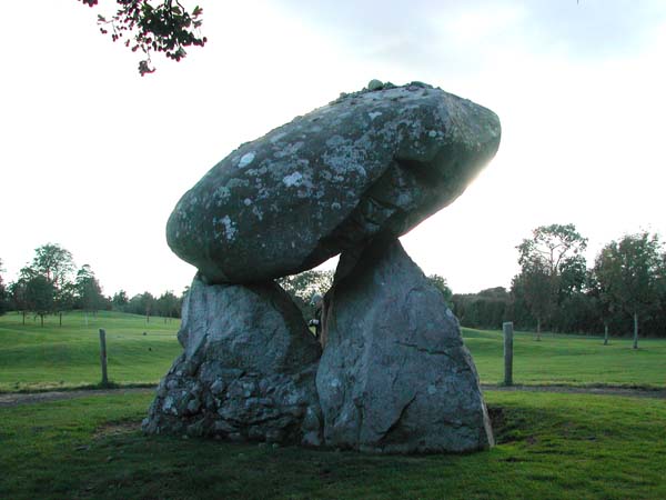 Megalithic tomb: the giant's grave; the long stones in DerryleckaghMegalithic Tomb: the Giant's Grave · 1439 yd
Explorer Tom The Giant's Grave in Derryleckagh is hiding a treasure that is definitely just a biscuit tin left by some confused…
 Church (in ruins) & graveyard: templegowran in DerryleckaghChurch (in ruins) & Graveyard: Templegowran · 1.2 mi
Explorer Tom Templegowran in Derryleckagh is playing hide-and-seek with me. A tale from 1846 says an earl built it, but there was no…
 Kilcock graveyard in Ballyholland LowerKilcock Graveyard · 1.6 mi
Explorer Tom Kilcock graveyard in Ballyholland Lower would tell its younger self to stop worrying about headstones and start…
 Derryleckagh BridgeVisitor information · 1.6 mi
Explorer Tom Derryleckagh Bridge in County Down is currently being judged by the local rabbits, who think it looks like a very…
 Crown BridgeBridge · 2.4 mi
Explorer Tom Crown Bridge at Creeve is from the 1650s, older than your great-grandfather's excuses. The local sheep definitely judge…
 Slieve RoosleyMountain / peak · 3.8 mi
Explorer Tom Slieve Roosley offers a shortcut that is actually just a very long way round in disguise. The locals know but they’re…
 Crotlieve MountainMountain / peak · 4.6 mi
Explorer Tom Crotlieve Mountain in County Down nearly got famous when a tourist mistook it for a UFO landing pad and started…
 Kilbroney HouseHouse · 4.6 mi
Explorer Tom Kilbroney House is doing its best impression of a dignified old lady who just wants a nap. I swear it smells faintly of…
 Yellow Water picnic sitePicnic place · 4.7 mi
Explorer Tom Yellow Water picnic site sits right off the Ulster Way, so expect hikers complaining about their blisters while eating…
 Rostrevor ForestForest · 5.1 mi
Explorer Tom Rostrevor Forest climbs above Carlingford Lough in County Down, carrying oakwood, conifers and a boulder so big it has…
 Oak WoodWood · 5.5 mi
Explorer Tom Oak Wood in County Down would tell you in an interview that it has strong roots, excellent stability, and no…
More archaeology and monuments in County Down · All of County Down

What do you know about this place?Tap to add a comment or ask a question