
What is recorded here
From the Northern Ireland Sites and Monuments Record record LDY007:016
Places near here
Photo credits
- Maker not stated on source page, en.wikipedia.org
- Maker not stated on source page, www.oliverstravels.com
- Albert Bridge, Geograph · CC BY-SA 2.0
- Maker not stated on source page, stock.adobe.com
- Albert Bridge, Wikimedia Commons · CC BY-SA 2.0
- Maker not stated on source page, thinplacestour.com
- Notafly, Wikimedia Commons · CC BY-SA 3.0
- Willie Duffin, Wikimedia Commons · CC BY-SA 2.0
- Maker not stated on source page, ru.pinterest.com
- Kenneth Allen, Wikimedia Commons · CC BY-SA 2.0
- Maker not stated on source page, www.flickr.com
- Shane Killen, Geograph · CC BY-SA 2.0
 Cairn & cist burial (O.S. memoir site, unlocated) in Ballynacally BegCairn & cist burial (O.S. memoir site, unlocated) · 795 yd
Explorer Tom Cairn & cist burial in Ballynacally Beg ended up in the wrong postcode, probably due to a clerical error by a very…
 Castle: somerset or the red castle in SomersetCastle: Somerset or the Red Castle · 1179 yd
Explorer Tom Somerset Castle claims a royal visit happened here in 1600s, but I suspect it was just a very fancy farmer. The red…
 Somerset ForestForest · 1285 yd
Explorer Tom Somerset Forest in County Derry is playing hide-and-seek with me, and I suspect it’s winning by a landslide because…
 Church & graveyard: drumtarssi (unlocated) in ChurchlandChurch & graveyard: drumtarssi (unlocated) · 1616 yd
Explorer Tom Church & graveyard: drumtarssi in Churchland is officially 'unlocated', which is hilarious because I’m standing right…
 Christie ParkPark · 1728 yd
Explorer Tom Christie Park puts Coleraine beside the River Bann, where a riverside path is an excellent excuse to let the town's…
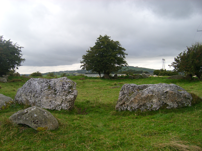 Stone StructureStone structure, possibly Crypt or Vault · 1.0 mi
Explorer Tom Stone Structure in Churchlands is possibly a crypt or vault. Very fancy, very secretive. A cow once tried to buy it…
 Mount Sandel FortArchaeological place · 1.0 mi
Explorer Tom Mount Sandel has a fort on the hill and a much older human story beside it. I nearly gave the wrong century to the…
 Terrace Row Presbyterian ChurchChurch · 1.1 mi
Explorer Tom Terrace Row Presbyterian Church has been standing there since the 1820s, probably judging everyone’s fashion choices. I…
 Mountsandel WoodWood · 1.2 mi
Explorer Tom Mountsandel Wood in County Derry is playing hide-and-seek with me, and I suspect it’s winning by a landslide because…
 Congregational ChurchChurch · 1.2 mi
Explorer Tom Congregational Church in Coleraine & suburbs, County Derry thinks the road leading to it is a bit too showy and flashy…
 Castle (O.S. Memoir site, unlocated) in GlenlearyCastle (O.S. Memoir site, unlocated) · 2.2 mi
Explorer Tom Glenleary Castle refuses to fall down because it’s too stubborn to admit it’s just a pile of rocks now. It’s playing…
 Quilley Picnic AreaPicnic place · 2.5 mi
Explorer Tom Quilley Picnic Area in County Derry has a table chained down because people keep stealing it. It’s like leaving your…
More archaeology and monuments in County Derry · All of County Derry

What do you know about this place?Tap to add a comment or ask a question