What is recorded here
Mortars and stones still mark the edge of Ballyvanen, though the hands that stacked them have long since crumbled to soil. A rath is a boundary drawn in stone, and boundaries require people fierce enough to keep them. Whether lovers, farmers or fleeing families lived inside that circle remains unknown. The stone still holds the shape of their urgency, waiting for a human voice to complete the sentence.
The official Northern Ireland record identifies this as RATH. Recorded period: E.CHRIST.. The official map point was placed at the centre of the recorded archaeological site from the source map reference.
The monument record does not grant public access. Check the route and ask the landowner before entering private land.
- What survives
- Recorded monument
Places near here
 Roses Lane Ends Former Post OfficePost Office · 1554 yd
 MEDIEVAL CHURCH; GRAVEYARD in OVAL ENCLOSURE with 2 BULLAUNS: DERBI or LALOO in BallinderryMEDIEVAL CHURCH; GRAVEYARD in OVAL ENCLOSURE with 2 BULLAUNS: DERBI or LALOO · 1.6 mi
 EARLY CHRISTIAN MONASTERY; ROUND TOWER; CHURCH SITE: ENIS-GARDEN or INIS-GARDEN or INIS-DRAICRENN or INIS-DAIRCAIRGREN or THE CHURCH OF LENNEWY? in Rams IslandEARLY CHRISTIAN MONASTERY; ROUND TOWER; CHURCH SITE: ENIS-GARDEN or INIS-GARDEN or INIS-DRAICRENN or INIS-DAIRCAIRGREN or THE CHURCH OF LENNEWY? · 1.7 mi
 Ram's IslandIslet · 1.7 mi
 Lady BayBay · 1.9 mi
 Ballinderry Moravian ChurchChurch · 2.0 mi
 Lignaboy PointHeadland · 2.4 mi
 Main StreetVisitor information · 2.6 mi
 C17TH CHURCH & GRAVEYARD: BALLINDERRY NEW CHURCH in BallinderryC17TH CHURCH & GRAVEYARD: BALLINDERRY NEW CHURCH · 2.9 mi
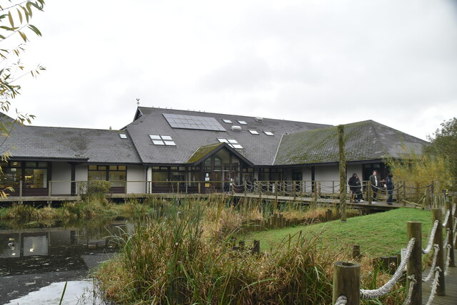 Lough Neagh Discovery CentreHeritage attraction · 6.9 mi
 Belshaw's Quarry Nature ReserveNature reserve · 7.1 mi
 WELL & ?CASTLE in InisloughlinWELL & ?CASTLE · 7.2 mi