
Places near here
Photo credits
- National Inventory of Architectural Heritage
- Jose Antonio Gutierrez D., Wikimedia Commons · CC BY-SA 4.0
- Martin Creek, Wikimedia Commons · CC BY-SA 2.0
- Espresso Addict, Geograph · CC BY-SA 2.0
- Philip Pötsch, Philipweb, Wikimedia Commons · CC BY 4.0
- Oliver Dixon, Geograph · CC BY-SA 2.0
- Fthierygeo, Wikimedia Commons · CC BY 4.0
- Humphrey Bolton, Geograph · CC BY-SA 2.0
- Wikimedia Commons contributor · CC BY-SA 3.0
- Frances Passey, Geograph · CC BY-SA 2.0
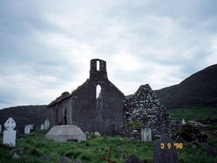 Séipéal na Cille [Killemlagh Catholic Chapel]Church/chapel · 583 yd
Explorer Tom Séipéal na Cille is playing possum without its roof, looking like it’s mid-sentence. It’d tell its younger self to stop…
 Wedge tomb in An Com (bar. Uíbh Ráthach)Wedge tomb · 2.0 mi
Explorer Tom Wedge tomb in An Com thinks one massive roof stone makes it look cool and mysterious. A goat used to rule this place…
 Bray Head Signal TowerRuins · 4.5 mi
Explorer Tom Bray Head Signal Tower is stuck in a feud with the family next door over who actually owns the best view of the…
 Bray HeadMountain / peak · 4.6 mi
Explorer Tom Bray Head in County Kerry is boasting about surviving a storm that wasn't even particularly wet, just damp and rude.…
 An Dún MórHeadland · 19 mi
Explorer Tom An Dún Mór is the headland where a matchmaker once worked and successfully paired off two clouds that are still…
 Dunmore HeadViewpoint · 19 mi
Explorer Tom Dunmore Head in County Kerry would tell a job interview it has excellent exposure to the Atlantic and zero patience for…
 Ogham stone in Com Dhíneol ThuaidhOgham stone · 19 mi
Explorer Tom Ogham stone in Com Dhíneol Thuaidh: If it were a person at a wedding, it would be the uncle who stands on the headland…
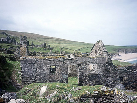 school19 mi
Explorer Tom School in Great-Blasket Island would handle a nosey neighbour by simply letting the wind do all the talking. It’s now a…
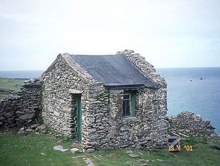 Tigh an Rí [The King's House]House · 19 mi
Explorer Tom Tigh an Rí on Great-Blasket Island is what Saint Patrick would have called a very expensive shed with royal ambitions.…
 Ionad an Bhlascaoid MhóirMuseum · 20 mi
Explorer Tom At Ionad an Bhlascaoid Mhóir in Dún Chaoin, the Blasket Islands sit across the water looking close enough to borrow a…
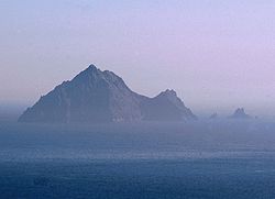 An TiarachtIslet · 21 mi
Explorer Tom An Tiaracht sits so far west that I would shout to America if the Atlantic ever quietened down. It is the westernmost…
 Inis TuaisceartMountain / peak · 22 mi
Explorer Tom Inis Tuaisceart in Kerry has hidden messages carved into its stones by ancient lovers who were too shy to speak them…
More archaeology and monuments in County Kerry · All of County Kerry

What do you know about this place?Tap to add a comment or ask a question