Places near here
Photo credits
- Colin Park, Wikimedia Commons · CC BY-SA 2.0
- Keith Cunneen, Geograph · CC BY-SA 2.0
- Nigel Cox, Geograph · CC BY-SA 2.0
- Espresso Addict, Wikimedia Commons · CC BY-SA 2.0
- Espresso Addict, Geograph · CC BY-SA 2.0
- National Inventory of Architectural Heritage
- John M, Geograph · CC BY-SA 2.0
- Gordon Hatton, Geograph · CC BY-SA 2.0
- Jeff Buck, Geograph · CC BY-SA 2.0
Explorer Tom This cluster of Hut sites in Rougham is three ruins sitting together along a steep slope. They’re all pretty ruinous and incomplete, like a family of ancient huts that just gave up on the decoration phase.
 CahaMountain / peak · 1.1 mi
Explorer Tom Caha in County Kerry refuses to fall down because it thinks gravity is being personal about its waistline. It stands there looking stoic while everyone else slides off into the bog, completely unbothered by the mess. Look serious, nod slowly, you're basically an expert now.
 Killane Mountain South-West TopMountain / peak · 1.7 mi
Explorer Tom Killane Mountain South-West Top has very strong opinions on modern building codes and hates that nobody respects its structural integrity. The path up looks easy until the ups and downs start messing with your head. Pretend it's yours and plan the housewarming right now.
 Gleninchaquin WaterfallWaterfall · 3.2 mi
Explorer Tom Gleninchaquin Waterfall is one hundred and forty metres of pure, unfiltered attitude, absolutely refusing to be impressed by anything but its own thunderous volume. The local sheep stare at it with a mix of respect and deep existential confusion every single day. Perfect spot to practise your best tour-guide voice.
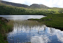 Uragh Wood Nature ReserveNature reserve · 3.5 mi
Explorer Tom Uragh Wood Nature Reserve in County bragged about surviving a storm so bad it shook the earth, but I think it just exaggerated the wind speed slightly. It’s standing there with its chest puffed out, acting like it did all the heavy lifting itself. Tell the kids it's a castle. Close enough.
 Uragh WoodForest · 3.8 mi
Explorer Tom Uragh Wood in County Kerry would tell the housing estate that replaced its neighbor it should have just admitted defeat and moved to the city. It’s standing there looking smug, knowing it survived while the rest got paved over for parking spaces. Ideal place to rehearse an excuse for being late.
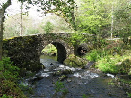 Glengarriff Nature ReserveBridge · 4.2 mi
Explorer Tom Glengarriff Nature Reserve bridge is picturesque and full of local craftsmanship, featuring a second smaller arch that acts as an overflow during floods. It’s part of the demesne group, so it’s basically the nature reserve's flood-control superhero. Bring your camera for the shot!
 Uragh Stone CircleArchaeological place · 4.2 mi
Explorer Tom This Uragh Stone Circle rates its visitors out of ten, and most of them are getting a three for standing in the wrong spot and blocking the view. It’s got a 10-foot stone that looks like it’s judging your entire soul from behind those nettles. Mind the nettles, they're the real guards here.
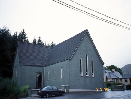 Saint Killian's Catholic ChurchChurch/chapel · 4.5 mi
Explorer Tom Saint Killian's Catholic Church in Derreen would complain to the council about the lack of parking for angels. It’s got a triangular porch that looks like it was cut with a knife. Mind the nettles, they're the real guards here.
 Garinish WestIslet · 5.1 mi
Explorer Tom Garinish West was once offered to a cow who wanted to buy it with a very shiny hoof, but the paperwork got lost in a storm. It’s just minding its own business while the waves crash around it. Stand still and listen, the wind tells it better than me.
 Ormond's IslandIslet · 6.2 mi
Explorer Tom Ormond's Island brags about surviving a storm so huge it claimed the waves were actually giant whales trying to eat it. It still stands there looking slightly damp and very proud of its survival skills, even if nobody else believes the story. Go before the tourists find out.
 Mare's Tail WaterfallViewpoint · 6.2 mi
Explorer Tom Mare's Tail Waterfall in County Cork has a bird that refuses to leave no matter how wet it gets. It sits right at the top, looking like it’s judging your swimming ability. The water is very loud and slightly dramatic about its own height. Bring a coin for luck and keep it in your pocket.
More mountains and hills in County Kerry · All of County Kerry

What do you know about this place?Tap to add a comment or ask a question