
What is recorded here
From the National Monuments Service (Archaeological Survey of Ireland) record KD040-032
Places near here
Photo credits
- Sitomon, Wikimedia Commons · CC BY-SA 2.0
- National Inventory of Architectural Heritage
- Maker not stated on source page, www.flickr.com
- Maker not stated on source page, knightstemplar.co
- Jean-Pol GRANDMONT, Wikimedia Commons · CC BY 3.0
- Maker not stated on source page, hu.pinterest.com
- Maker not stated on source page, en.wikipedia.org
- Maker not stated on source page, commons.wikimedia.org
- Maker not stated on source page, www.dreamstime.com
- Maker not stated on source page, www.pinterest.com
- A.-K. D., Wikimedia Commons · CC BY-SA 4.0
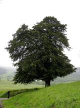 European Yew1269 yd
Explorer Tom European Yew in County Carlow is doing its best impression of a medieval murder weapon while looking ancient. It's…
 Burton HallCountry house · 1269 yd
Explorer Tom This bit of Burton Hall is basically one wing of a house that got divorced from its siblings. The staircase survived…
 Ballinakelly WoodForest · 1301 yd
Explorer Tom Ballinakelly Wood is refusing to fall down because it thinks gravity is just a suggestion for trees. It stands there…
 worker's house1336 yd
Explorer Tom Worker's house in Killyshane is semi-detached with dormer attics and granite facades, arranged in four pairs like…
 CastleCastle, unclassified · 1419 yd
Explorer Tom Castle in Burtonhall Demesne was once 'in good repair,' which is doing a lot of heavy lifting there. Now nobody can…
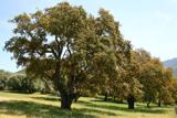 Cork oak1716 yd
Explorer Tom Cork oak tree is basically a giant sponge wearing a suit and tie. If it were a person at a wedding, it would be the…
 Mapped cemeteryCemetery · 1.5 mi
Explorer Tom This Mapped Cemetery holds a fake world record for the most crooked gravestones in a single row. We measured it with a…
 St. Michaels Church (Site of)Church · 1.6 mi
Explorer Tom St. Michaels Church in Prumpelstown Lower is basically foundations now, but the sheep have strong opinions on its…
 Mapped graveyardGraveyard · 1.6 mi
Explorer Tom Look closely at the stones in this mapped graveyard in Kildare; they are spelling out a hidden message about bad…
 Graveyard in Prumpelstown LowerGraveyard · 1.6 mi
Explorer Tom Prumpelstown Lower is prouder of its little font base than most people are of their first cars. It’s got a church…
 Field system in Ballaghmoon Castle,knocknageeField system · 1.9 mi
Explorer Tom Field system in Ballaghmoon Castle, Knocknagee has fosses so curvy they’d make a dance instructor weep. A matchmaker…
 Clogrenan CastleCastle, tower house · 6.5 mi
Explorer Tom Castle in Clarahill refuses to fall down because it thinks gravity is just a suggestion for polite society. It’s been…
More archaeology and monuments in County Kildare · All of County Kildare

What do you know about this place?Tap to add a comment or ask a question