
What is recorded here
From OpenStreetMap (© OpenStreetMap contributors) w316801527
Places near here
Picture notes
- Computer-made picture. It does not show this holy well.
- Computer-made picture. It does not show this monument.
- National Inventory of Architectural Heritage
- GenesisNZ, Wikimedia Commons · CC BY-SA 4.0
- Simon Huguet, Wikimedia Commons · CC BY-SA 2.0
- Chris, Geograph · CC BY-SA 2.0
- Roger Diel, Geograph · CC BY-SA 2.0
- Richard cattel, Geograph · CC BY-SA 2.0
- Gordon Hatton, Geograph · CC BY-SA 2.0
- Eddylandzaat, Wikimedia Commons · CC BY 3.0
 St Connells WellHoly well · 171 ydTom: I’m here to help · Computer-made picture. It does not show this holy well.
Explorer Tom St Connells Well is tucked away in Doonogan, so remember to check with locals if the path to its waters is open.
 Fairy fort / earthen ringfort in DoonoganFairy fort / earthen ringfort · 733 ydTom: I’m here to help · Computer-made picture. It does not show this monument.
Explorer Tom Another Fairy fort / earthen ringfort in Doonogan keeps its story close, so make sure to check access rights with the owner.
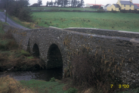 Aghy BridgeBridge · 1.2 mi
Explorer Tom Aghy Bridge is a double-arch rubble stone road bridge built around 1800 with V-cutwaters and voussoirs.
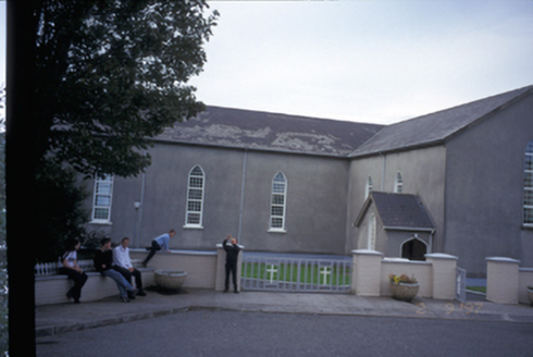 Saint Mary's Roman Catholic ChurchChurch/chapel · 1.2 mi
Explorer Tom Finnor More’s Saint Mary’s is a T-plan church built in 1844 with four-bay side elevations and gabled porches.
 Spanish Point BeachBeach / strand · 3.2 mi
Explorer Tom Spanish Point Beach is an extensive sandy stretch west of Milltown Malbay, though you’ll need to watch the bye-laws.
 Emlagh PointHeadland · 3.3 mi
Explorer Tom Emlagh Point is a headland in County Clare, perhaps offering a panoramic view of the bay and the western coastline ahead.
 Spanish PointVisitor information · 3.4 mi
Explorer Tom Spanish Point has me wondering if it's a place where the Spanish Armada once landed; the account doesn't say what's special about it.
 Caherrush Castle (in Ruins)Castle, tower house · 3.6 mi
Explorer Tom Caherrush Castle sits quietly near Spanish Point, and you must check with the landowner before stepping onto this private tower house.
 Tromra CastleCastle, tower house · 3.7 mi
Explorer Tom Tromra Castle stands proudly on level marshy ground, keeping a close, curious eye on the distant Mutton Island to the northwest.
 Seafield North BeachBeach / strand · 4.1 mi
Explorer Tom Seafield North Beach gives views of Seafield harbour and Mutton Island in the distance, perfect for a wander.
 Lurga PointHeadland · 4.5 mi
Explorer Tom Lurga Point stretches boldly toward Mutton Island, where the rocky reef meets the ocean in a splashy, wild embrace.
 SlievecallanMountain / peak · 5.4 mi
Explorer Tom Slievecallan, a mountain that’s as rugged as the winter landscape it’s dressed in during January.
More archaeology and monuments in County Clare · All of County Clare

What do you know about this place?Tap to add a comment or ask a question