
What is recorded here
Rocque’s 1760 Map of County Dublin shows the Roman Catholic ‘Chapple’ on the E side of Balrothery village (Rocque 1762). On this map the chapel is depicted as a rectangular building orientated N-S on its long axis, standing on the W side of a roadway, with laneway to N running W towards the main street/road running through the village of Balrothery. This R. C. Chapel is depicted at the same location on the first edition of the OSi 6-inch map. The laneway to the N is also shown on this map. On the revised editions of the OSi 6-inch map and on the 25-inch map the church is now annotated as a ‘School’. The website of the Balrothery national School recorded that ‘In 1842 when the parish church was built in Balbriggan the school occupied the old church which had been built in 1722 in penal times in a very secluded spot’ (https://www.balrotheryns.com/our-school/school-history/).
Compiled by: Caimin O'Brien
A local church or high cross; wider significance not recorded.
The monument record does not grant public access. Check the route and ask the landowner before entering private land.
- What survives
- Recorded monument
Places near here
 KilnKiln, corn-drying · 137 yd
 Holy WellHoly well · 181 yd
 Hilltop enclosure in RoseparkHilltop enclosure · 267 yd
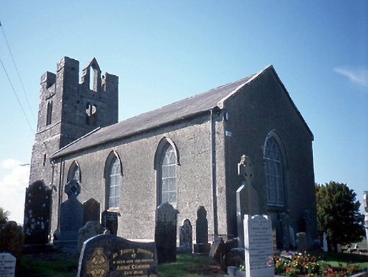 Saint Peter's Church (Balrothery)church/chapel · 390 yd
 Balrothery Heritage CentreMuseum · 391 yd
 Balrothery TowerCastle · 406 yd
 Flat cemetery in DarcystownFlat cemetery · 521 yd
 Wavin LakesNature reserve · 1192 yd
 Barn WoodWood · 1337 yd
 Castle (remains of)Castle, tower house · 1409 yd
 Ardgillan Castle and DemesneHeritage attraction · 1756 yd
 BBQ AreaPicnic place · 1.1 mi
Other information
Photo: Credit not shown in the picture search · Rights wording not checked; contact us if this picture should be removed