
What is recorded here
Archaeological testing (03E1729) on a site fronting onto Paul Quay and bordered by Oyster Lane on the NW and which is c. 50m S of the Crescent uncovered sections of a number of walls running NE-SW. One wall (Wth 1.6m), encountered at a depth of 1.3m had organic layers containing Leinster ware to its NW and is interpreted as a possible quay-wall with a lagoon on the NW and perhaps infill material to the SE. (McLoughlin 2004; 2006)
Compiled by: Michael Moore
Date of upload: 20 December, 2012
Archaeological testing (03E1729) on a site fronting onto Paul Quay and bordered by Oyster Lane on the NW and which is c. 50m S of the Crescent uncovered sections of a number of walls running NE-SW. One wall (Wth 1.6m), encountered at a depth of 1.3m had organic layers containing Leinster ware to its NW and is interpreted as a possible quay-wall with a lagoon on the NW and perhaps infill material to the SE.…
From the National Monuments Service (Archaeological Survey of Ireland) record WX037-032027
The monument record does not grant public access. Check the route and ask the landowner before entering private land.
- What survives
- Recorded monument
Places near here
Photo credits
- National Inventory of Architectural Heritage
- Thommcg1980, Wikimedia Commons · CC BY-SA 4.0
- AFBorchert, Wikimedia Commons · CC BY-SA 4.0
- Danielclauzier, Wikimedia Commons · CC BY-SA 3.0
- Andreas F. Borchert, Wikimedia Commons · CC BY-SA 4.0
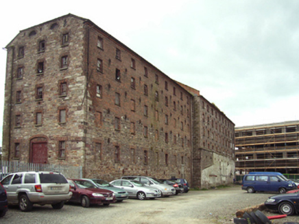 granary23 yd
 custom house82 yd
 Michael BroadersHouse · 103 yd
 cobbles/flags/paving/kerbing107 yd
 cobbles/flags/paving/kerbing115 yd
 post box153 yd
 Commodore John Barry MemorialMemorial · 153 yd
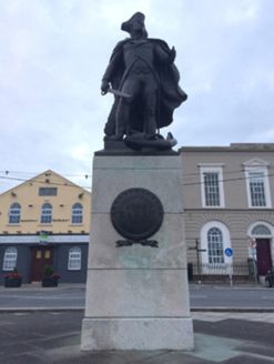 Commodore John Barry MonumentMonument · 153 yd
 Historic buildingOfficially recorded historic building · 155 yd
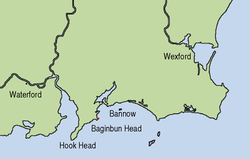 Siege of WexfordSiege · 286 yd
 Sack of WexfordSiege · 290 yd
 1798 MemorialMemorial · 507 yd
More archaeology and monuments in County Wexford · All of County Wexford
What do you know about this place?