What is recorded here
From the National Monuments Service (Archaeological Survey of Ireland) record GA033-022
Places near here
Photo credits
- Maker not stated on source page, www.flickr.com
- Maker not stated on source page, www.pinterest.com
- Maker not stated on source page, www.irishexaminer.com
- Maker not stated on source page, www.visitgalway.ie
- Maker not stated on source page, ru.wikipedia.org
- Mike Searle, Geograph · Creative Commons Attribution-ShareAlike 2.0
- Maker not stated on source page, en.wikipedia.org
- National Inventory of Architectural Heritage
- Maker not stated on source page, uk.pinterest.com
- Maker not stated on source page, au.pinterest.com
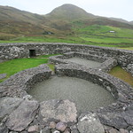 Fairy fort / earthen ringfort in Aghrane or Castlekelly,cloonruff (killian By.)Fairy fort / earthen ringfort · 626 yd
Explorer Tom Fairy fort in Aghrane OR Castlekelly, Cloonruff has a solid retirement plan: just lay down in the grass and do nothing.…
 Cloonruff Holy WellHoly well · 748 yd
Explorer Tom Cloonruff Holy Well has a tombstone that would read 'Died of thirst, 1780.' It's just a hollow with a little cross next…
 Fairy fort / earthen ringfort in LisheenteigeFairy fort / earthen ringfort · 1096 yd
Explorer Tom Fairy fort / earthen ringfort in Lisheenteige took about forty cups of tea to build, judging by the sheer amount of…
 Castle KellyCountry house · 1.0 mi
Explorer Tom Castle Kelly refuses to fall down because it's waiting for the right person to trip over its foundation. It's got that…
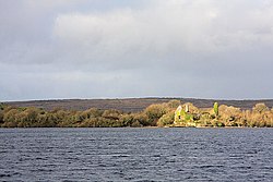 InchaquinIslet · 1.1 mi
Explorer Tom Inchaquin in County Roscommon has stones that are whispering messages to anyone who listens close enough, but they’re…
 Mount Talbot HouseCountry house · 1.1 mi
Explorer Tom Mount Talbot House is getting picked on by the wind because it burned down in 1922 and now just stands there looking…
 Deerpark Ballygar, St Brendan's Football ClubGAA ground · 1.2 mi
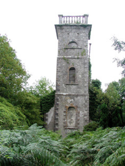 Mount Talbot Church (Tisrara)Church/chapel · 1.2 mi
Explorer Tom Mount Talbot Church in Tisrara is planning its retirement very carefully. It wants to turn into a fancy garden center…
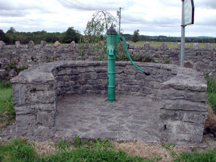 Historic buildingOfficially recorded historic building · 1.3 mi
Explorer Tom This historic water pump in Mount Talbot is surrounded by a curving stone wall and has a cow tail style handle that…
 CastleCastle, unclassified · 1.6 mi
Explorer Tom Castle in Lismaha, County Roscommon has 'Burned Down' as its favourite song because it fits the vibe so well…
 Mapped cemeteryCemetery · 1.7 mi
Explorer Tom This Mapped Cemetery in County Galway would complain to the council about the overgrown grass covering up its best…
 Site of Ballygar CastleCastle, unclassified · 2.0 mi
Explorer Tom Site of Ballygar Castle is just a faint rise in the ground, so you’ll need to squint really hard or bring a magnifying…
More historic places in County Galway · All of County Galway

What do you know about this place?Tap to add a comment or ask a question