What is recorded here
From the Irish Caves Database, University of Bristol Spelæological Society record 1759
Places near here
Picture notes
- Computer-made picture. It does not show this monument.
- Computer-made picture. It does not show this cliff.
- The original uploader was Rwxrwxrwx at English Wikipedia ., Wikimedia Commons · CC BY-SA 3.0
- Colin Park, Geograph · CC BY-SA 2.0
- Roger Diel, Geograph · CC BY-SA 2.0
- National Inventory of Architectural Heritage
- P.hammer, Wikimedia Commons · CC BY-SA 3.0
- Computer-made picture. It does not show this mountain top.
- Mark Waters, Wikimedia Commons · CC BY 2.0
- Computer-made picture. It does not show this playground.
 Hut site in CrumlinHut site · 509 ydTom: I’m here to help · Computer-made picture. It does not show this monument.
Explorer Tom The second Crumlin hut site is basically a slightly squashed circle right next to that same big cashel. The wind probably picked on it because it stood out too much with its low walls. Bring a jacket, it's never as warm as I promise.
 Man-made underground passage in CrumlinMan-made underground passage · 799 ydTom: I’m here to help · Computer-made picture. It does not show this monument.
Explorer Tom This Crumlin underground passage is an L-shaped structure that looks like it was carved by someone who couldn’t decide which way to go. It’s sheltered on a terrace and smells like damp earth and old secrets. Stand still and listen, the wind tells it better than me.
 OughtdarraCliff · 1.4 miTom: I’m here to help · Computer-made picture. It does not show this cliff.
Explorer Tom This stretch of Oughtdarra cliff drops steeply into the greenery below, reminding every hiker that gravity is always in charge.
 AilladieCliff · 1.7 mi
Explorer Tom Ailladie stands tall as a cliff in County Clare, perfect for spotting climbers scaling its impressive middle sectors today.
 FaunarooskaCave · 2.0 mi
Explorer Tom Faunarooska sits on the Burren, near Black Head; I picture dramatic cliffs and winds that make your hair stand up.
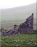 Faunarooska Castle (in ruins)Castle, tower house · 2.0 mi
Explorer Tom Faunarooska Castle in Faunarooska is planning its retirement on the slopes of Slieve Elva. It looks like it’s napping with one eye open at the Aran Islands. Hum something sad nearby, it adds atmosphere.
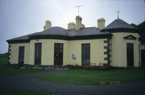 Ballinalacken CastleHouse · 2.8 mi
Explorer Tom Ballinalacken Castle in Ballynalackan is playing dress-up, swapping castle vibes for hotel chic with its new wing. It looks like it’s trying too hard to impress the tourists. Tell the kids it's a castle. Close enough.
 Doolin CaveCave · 3.3 mi
Explorer Tom Doolin Cave stands proud in County Clare, and I can practically hear the sea echoing off its stone walls.
 KnockacarnMountain / peak · 3.8 miTom: I’m here to help · Computer-made picture. It does not show this mountain top.
Explorer Tom Knockacarn is a rugged presence in the hills, its summit marked by the enduring strength of the land it guards.
 Site of Lisdoonvarna CastleCastle, tower house · 4.4 mi
Explorer Tom Site of Lisdoonvarna Castle would be a total disaster on a reality show, probably losing its footing in episode one. It’s a bit of a mess now, but ideal stop for a big stretch and a bigger yawn.
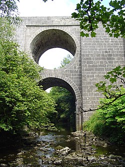 Spectacle BridgeBridge · 4.4 mi
Explorer Tom Spectacle Bridge in Aughiska Beg is just one big arch over a deep gorge, built around 1850. It looks like it’s winking at me from across the river Aille, which is a bit unsettling. Visit, then text me what you think. I'll pretend to read it.
 Children's playground4.8 miTom: I’m here to help · Computer-made picture. It does not show this playground.
Explorer Tom A children's playground that’s filled with activity and the sounds of laughter in County Clare.
More caves in County Clare · All of County Clare

What do you know about this place?Tap to add a comment or ask a question