Places near here
Photo credits
- Colin Park, Geograph · CC BY-SA 2.0
- Roger Diel, Geograph · CC BY-SA 2.0
- Sometimes Incoherent, Wikimedia Commons
- P L Chadwick, Geograph · Creative Commons Attribution-ShareAlike 2.0
- National Inventory of Architectural Heritage
- John M, Geograph · CC BY-SA 2.0
- No machine-readable author provided. Bogman assumed (based on copyright claims)., Wikimedia Commons · CC BY 2.5
- The original uploader was Rwxrwxrwx at English Wikipedia ., Wikimedia Commons · CC BY-SA 3.0
- Andreas F. Borchert, Wikimedia Commons · CC BY-SA 4.0
- Andy Waddington, Wikimedia Commons · CC BY-SA 2.0
 FaunarooskaCave · 1054 yd
Explorer Tom Faunarooska in County Clare inspired a bad poem about its 'rocky soul' that made a local poet cry into his stew. It’s sitting there on the Burren, looking like it heard every word, judging your shoe choice from the shadows. Best enjoyed with a bag of chips and no plans.
 Slieve ElvaMountain / peak · 1610 yd
Explorer Tom Slieve Elva is playing hard to get in County Clare, sitting there all smug on its peaty bog throne while a ghost fiddler plays the tunes it refuses to reveal. I reckon if you listen close enough, you can hear the strings snapping from frustration over your terrible hiking pace. Go in good boots and better humour.
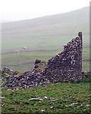 Faunarooska Castle (in ruins)Castle, tower house · 1.1 mi
Explorer Tom Faunarooska Castle watched the Vikings get completely lost looking for it because they were too busy fighting over who had the better beard. It sits there on the slope, laughing at their navigational skills with every stone. Visit, then text me what you think. I'll pretend to read it.
 PoulnagollumCave · 1.5 mi
Explorer Tom Poulnagollum is over sixteen kilometres of underground Clare, so I will not be offering to lead you round before lunch. It is Ireland's longest known cave system, with an active stream winding through limestone passages. Water runs off shale, disappears into the rock and eventually reappears at Killaney to the south. T. J. Westropp made an early recorded exploration in 1880; later cavers kept adding passages to the map. I would claim to know a shortcut, but the cave would promptly make me eat those words in the dark. This is a real caving place, not a fitted public show cave. Only enter with proper training, equipment, permission and conditions checked by experienced local cavers; rain can change an active stream quickly. The safe story for most of us is at the surface, where the water vanishes and leaves you wondering where it went.
 Grave YardGraveyard · 1.6 mi
Explorer Tom Graveyard in Craggagh would cope brilliantly on a reality show because it has great views and zero drama. St. Onchon built it ages ago and left it to rot stylishly. Practise your Irish on it, it won't correct you.
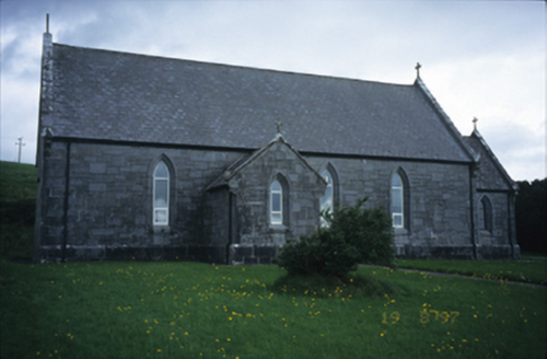 Catholic Church of Our Lady of LourdesChurch/chapel · 2.7 mi
Explorer Tom Catholic Church of Our Lady of Lourdes in Kilmoon West is having a bit of a moment with its limestone, isn’t it? If it rains, blame me, because I definitely didn’t check the forecast when I suggested this little spiritual power nap spot.
 Fanore BeachVisitor information · 2.8 mi
Explorer Tom Fanore Beach is actually run by a dog who barks at anyone who doesn’t bring enough treats, so make sure you’re prepared to pay the toll in biscuits or be chased off. The rain was persistent with a strong breeze, which just means the dog is having a bad day and you’re getting wet for no reason. Leave nothing but footprints and a bad pun.
 Ballinalacken CastleCastle · 3.0 mi
Explorer Tom Ballinalacken Castle stands over a Burren road junction like an old traffic officer with very thick walls. Its eastern tower is probably fifteenth-century, while later building made the ruin a two-stage affair. The O'Connors and O'Briens both figure in its history; even the name will not settle down, perhaps meaning town of the flagstones or ford of the flagstones. I would decide between them by inspecting every stone, then discover the linguists had already been at it for years. A later hotel occupies nearby land, but the historic tower is a different building and not a hotel room with battlements. Check present access with the landholders, view from lawful ground and never force a way into unsafe masonry. From below, follow the roads with your eye. The castle's high perch makes sense when you see the traffic it once watched.
 AilladieCliff · 3.0 mi
Explorer Tom Ailladie is eight hundred metres of Clare limestone that makes climbers grin and makes me check where my feet are. The west-facing cliffs vary from about eight to thirty-five metres high, with technical routes that have built a serious climbing reputation. Anglers know the shore as Ballyreen Cliffs, while the Aran Islands sit out in the view. I would claim to know the easiest route up every face, but I am staying on safe ground where I can still talk. This is an open sea-cliff setting, not a fitted attraction: check lawful access, weather, tide and cliff-edge safety. Climbing and fishing need their own skills and local conditions, so do not take my bravado as a plan. From a safe viewpoint, watch the evening light on the stone. It is handsome enough without anybody hanging from it.
 Wedge tomb in Faunarooska (rathborney Ed)Wedge tomb · 3.0 mi
Explorer Tom Wedge tomb in Faunarooska got the name wrong because the map maker was clearly drunk on whiskey and mistook a rock for a treasure chest. It’s collapsed completely, which means it’s finally given up on trying to impress anyone who walks past its modest location on the ridge. Perfect detour when the satnav has a meltdown.
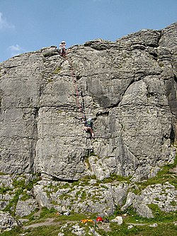 BallyryanCliff · 3.0 mi
Explorer Tom Ballyryan cliff would post on social media something like 'Just standing here, feeling very vertical,' with a filter that makes the sky look purple. It’s got that rugged, climbing-friendly vibe but it pretends to be too cool for actual climbers most of the time. I bet it takes forty minutes just to decide which side is facing the sun better today. Bring a pen pal, they'll be jealous.
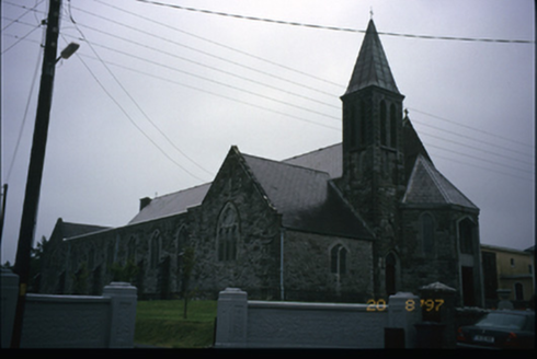 Corpus Christi Catholic ChurchChurch/chapel · 3.2 mi
Explorer Tom Corpus Christi Catholic Church in Rathbaun is trying very hard to look important with its tower and spire. Best seen with a hangover and a sausage roll, because the spiritual energy helps you forgive yourself for the greasy breakfast choice.
More caves in County Clare · All of County Clare

What do you know about this place?Tap to add a comment or ask a question