What is recorded here
From the Irish Caves Database, University of Bristol Spelæological Society record 1671
The cave register does not grant public access. Check conditions and ask the landowner before entering private land.
Places near here
Photo credits
- P.hammer, Wikimedia Commons · CC BY-SA 3.0
- National Inventory of Architectural Heritage
- No machine-readable author provided. Bogman assumed (based on copyright claims)., Wikimedia Commons · CC BY 2.5
- The Banner, Wikimedia Commons · CC BY-SA 3.0
- Andy Waddington, Wikimedia Commons · CC BY-SA 2.0
- No machine-readable author provided. Bogman assumed (based on copyright claims)., Wikimedia Commons · CC BY-SA 2.5
- Gareth James, Geograph · CC BY-SA 2.0
Explorer Tom Doolin Cave Visitor Centre is a gateway to history, where the caves' secrets are revealed through guided tours in County Clare.
 Doolin CaveCave · 133 yd
Explorer Tom Doolin Cave stands proud in County Clare, and I can practically hear the sea echoing off its stone walls.
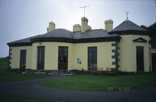 Ballinalacken CastleHouse · 724 yd
Explorer Tom Ballinalacken Castle pairs an octagonal bay with a ruined medieval tower, creating a fascinating architectural dialogue in Ballynalackan.
 Ballinalacken CastleCastle · 733 yd
Explorer Tom Ballinalacken Castle is a two-stage towerhouse near Doolin, standing as a silent witness to centuries of history in County Clare.
Enclosure in PouliskaboyEnclosure · 896 ydExplorer Tom This roughly circular scarp in Pouliskaboy is barely visible, hidden beneath scrub and modern field boundaries.
St. Catherine's OneCave · 1686 ydExplorer Tom St. Catherine's One is recorded in Clare, maybe linked to old colleges, but the map doesn't guarantee entry rights.
 Catholic Church of the Holy RosaryChurch/chapel · 1.5 mi
Explorer Tom In Ballyvoe, the Holy Rosary church from 1820 wears a trefoil opening above its door. Its paired lancet windows suggest a history of community gathering and prayer.
The BurrenHeritage attraction · 1.6 miExplorer Tom The Burren is a unique landscape in County Clare, where stone deserts and ancient secrets await those brave enough to explore.
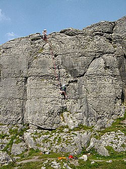 BallyryanCliff · 1.8 mi
Explorer Tom Ballyryan is a lovely limestone cliff in County Clare, just right for quick, sunny climbs with friends on a nice day.
OughtdarraCliff · 1.9 miExplorer Tom Near Rose Cottage, the Oughtdarra cliff stands tall, a dramatic backdrop for anyone seeking a bit of coastal mystery and intrigue.
 Court tomb in TeergoneanCourt tomb · 2.1 mi
Explorer Tom Picture a limestone hollow where a curious two-chambered gallery waits under overgrowth, tucked within an old field system in Teergonean.
 Doonmacfelim Castle (in Ruins)Castle, tower house · 2.5 mi
Explorer Tom Perched on a natural mound beside the Aille River, Doonmacfelim Castle offers wide views while guarding secrets of O'Connor and O'Brien ownership.
More caves in County Clare · All of County Clare
What do you know about this place?