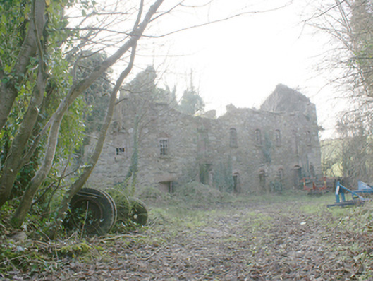
What is recorded here
Detached multiple-bay three-storey former corn mill, built c. 1860 and possibly containing the fabric of an earlier mill to site, c. 1800. Not out of use and derelict. Pitched roof, now collapsed, having remains of cut stone eaves course. Rubble stone walls. Segmental-headed window openings having stone sills, red…
Read the whole record
From the Buildings of Ireland (National Inventory of Architectural Heritage) record 40905455
Places near here
Picture notes
- National Inventory of Architectural Heritage
- Computer-made picture. It does not show this playground.
- Richard Webb, Wikimedia Commons · CC BY-SA 2.0
- Kenneth Allen, Wikimedia Commons · CC BY-SA 2.0
- Sitomon, Wikimedia Commons · CC BY-SA 2.0
- Eeno11, Wikimedia Commons · CC BY-SA 3.0
- Kenneth Allen, Geograph · CC BY-SA 2.0
- P L Chadwick, Geograph · CC BY-SA 2.0
- Andreas F. Borchert, Wikimedia Commons · CC BY-SA 4.0
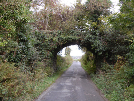 bridge359 yd
Explorer Tom Bridge in Pluck used to carry a tiny narrow-gauge train right across that wide country gap. I picture the little engine puffing smoke like a grumpy grandpa, convinced it was the only vehicle important enough to cross the road.
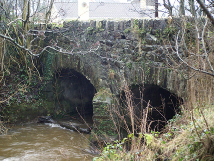 Connaghan's BridgeBridge · 654 yd
Explorer Tom Connaghan's Bridge has a V-shaped stone nose pointing straight at the Corkey River. I bet the masons in 1800 thought it was the only way to stop the water from getting cheeky with their new road.
 Children's playground1382 ydComputer-made picture. It does not show this playground.
Explorer Tom Another Children's playground in County Donegal that smells faintly of rubber and regret. I bet the see-saw has a favorite side because everyone cheats. If anyone asks why you are here, tell them Tom sent you.
 Battlefield in Tully (kincraigy Ed),glenmaquin Lower,roosky (castleforward Ed)Battlefield · 2.1 mi
Explorer Tom Battlefield in Tully, Glenmaquin Lower, Roosky is a patch of earth that remembers being trampled by very angry people. It's quiet now, but the ground still feels like it's holding its breath. Stand where the owner stood and practise looking smug about your discovery.
 Battle of FarsetmoreBattle · 2.5 mi
 European Yew3.2 mi
Explorer Tom European Yew in County Donegal is a yew, which means it’s tough, old, and probably poisonous if you look at it wrong. It’s the kind of tree that survives empires and bad haircuts. Bring your own legend, I've run out, make up a story about a dragon living in its branches.
 Rowan3.3 mi
Explorer Tom Rowan in County Donegal is hiding because it thinks it wards off witches, but I'm pretty sure it just hates the rain. It needs permission to exist properly. Ask it politely if it wants a cup of tea.
 Mongorry HillMountain / peak · 3.4 mi
Explorer Tom Mongorry Hill is having a bit of an identity crisis, probably because 'Mongorry' sounds like a dog that stole your sandwich. It’s just sitting there being a peak in County Donegal. Perfect detour when the satnav has a meltdown.
 CostaCafé · 3.5 mi
Explorer Tom Costa in Letterkenny is selling coffee that wakes up the dead faster than a shock. Grab a latte before they change their hours and lock you out!
 Aka Big ParkChildren's playground · 3.6 miComputer-made picture. It does not show this playground.
Explorer Tom Aka Big Park in County Donegal sounds like it was named by a drunk uncle. Probably full of swinging kids and lost socks. Wave at the swings for me on your way through the fun zone.
 The Yellow PepperRestaurant · 3.7 mi
Explorer Tom The Yellow Pepper in County Donegal is clearly named for the spice level, not the colour of the walls. I’d love a mild one, but they probably don’t do that here, do they?
 Cathedral4.9 mi
Explorer Tom Cathedral in Raphoe Townparks is a palimpsest of history, with 9th-century carvings hiding inside its modern walls. Adomnán himself was linked to this monastery back in the 7th century, so that ground has seen more than just your average Sunday service.
More historic places in County Donegal · All of County Donegal

What do you know about this place?Tap to add a comment or ask a question