
What is recorded here
From the Northern Ireland Sites and Monuments Record record TYR009:001
Places near here
Photo credits
- Maker not stated on source page, tr.pinterest.com
- Kenneth Allen, Geograph · CC BY-SA 2.0
- Maker not stated on source page, www.locationscout.net
- Kenneth Allen, Geograph · Creative Commons Attribution-ShareAlike 2.0
- Kenneth Allen, Wikimedia Commons · CC BY-SA 2.0
- National Inventory of Architectural Heritage
- Des Colhoun, Wikimedia Commons · CC BY-SA 2.0
- Kmcnamee, Wikimedia Commons · CC BY-SA 4.0
 Standing stone in SkelpyStanding stone · 1608 yd
Explorer Tom Standing stone in Skelpy is no longer visible, having vanished from what used to be rocky marsh land. It was marked on…
 Fearn HillMountain / peak · 1.2 mi
Explorer Tom Fearn Hill sits in County Donegal with its access details completely unknown to the mapmakers. The only clue is a…
 Standing stone in RogansparkStanding stone · 1.5 mi
Explorer Tom Standing stone in Roganspark is likely handling a nosey neighbour by just standing there with its arms crossed, which…
 St. Columba's Catholic ChurchChurch/chapel · 1.5 mi
Explorer Tom St. Columba's Catholic Church has these tiny Celtic crosses on the very top of its roof, just poking up there. It looks…
 Urney Presbyterian ChurchChurch · 1.6 mi
Explorer Tom Urney Presbyterian Church has been listening to the same sermons since the seventeen-forties, which must be exhausting…
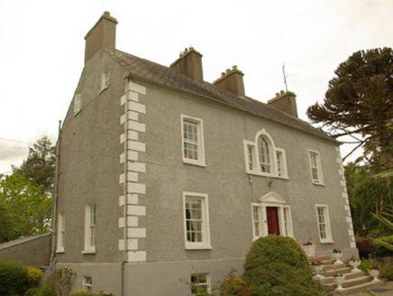 Magherycallaghan HouseCountry house · 1.6 mi
Explorer Tom Magherycallaghan House in Magherycallaghan is being claimed by a local as his own invention, which is bold for a house…
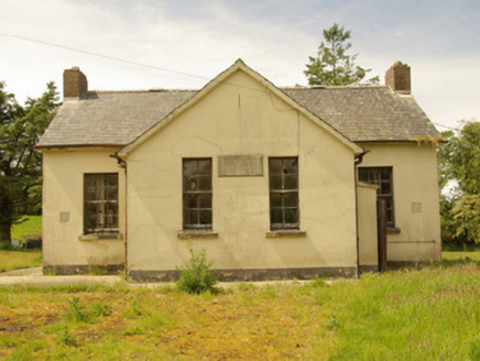 Alt National SchoolSchool · 1.7 mi
Explorer Tom Alt National School has its name and 1934 date cut into a stone plaque. A newer school opened nearby in 1960, but those…
 Battle site: in 789 AD & battle of the fords , Southern crossing, 1689 in Clady; DonnygowanBattle site: in 789 AD & battle of the fords , Southern crossing, 1689 · 1.7 mi
Explorer Tom Battle site: in 789 AD & battle of the fords, Southern crossing, 1689 in Clady has been waiting for a prophecy to come…
 Clady BridgeBridge · 1.7 mi
Explorer Tom Clady Bridge in Donnygowen has very strong opinions on modern buildings and thinks they’re all a bit too shiny. It’s…
 Birdstown Standing StonePublicly named standing stone · 1.8 mi
Explorer Tom Birdstown Standing Stone might be a very tall rock that birds use as a secret landing pad. I bet they land there to…
 Battlefield in Cloghfin (castlefin Ed)Battlefield · 1.8 mi
Explorer Tom Battlefield in Cloghfin is actually run by a terrier named Buster who barks at anyone who steps too close to the old…
 Cutt Park, St. Columba's GAA, UrneyGAA ground · 1.8 mi
More archaeology and monuments in County Tyrone · All of County Tyrone

What do you know about this place?Tap to add a comment or ask a question