
Places near here
Photo credits
- National Inventory of Architectural Heritage
- Kmcnamee, Wikimedia Commons · CC BY-SA 4.0
- Dunderry GAA Club (individual photographer not stated), www.dunderrygaa.com
- Rob Hurson, Wikimedia Commons · CC BY-SA 4.0
- Kieran Campbell, Geograph · Creative Commons Attribution-ShareAlike 2.0
- Ronnie Nijboer, Wikimedia Commons · CC0
- Roger Culos, Wikimedia Commons · CC BY-SA 3.0
- Aubrey Martin, Wikimedia Commons · CC BY-SA 4.0
- Albert Bridge, Geograph · CC BY-SA 2.0
- Mike Searle, Geograph · CC BY-SA 2.0
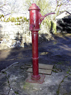 water pump1.3 mi
Explorer Tom Water pump in Ardbraccan is being ignored by rabbits who think it’s a fancy bench. It pumped water for centuries and…
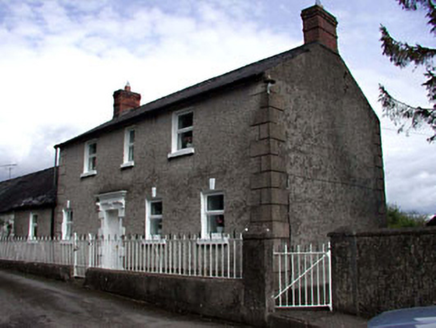 Ardbraccan HouseWorker's house · 1.3 mi
Explorer Tom Ardbraccan House in County Meath is a worker’s pad that probably spills secrets after three pints. It stands next to…
BohermeenMountain / peak · 1.5 miExplorer Tom Bohermeen was built on a bargain with a ghost who wanted a quiet life. The name sounds like 'be very mean' but it's…
 O'Mahony's GAA, NavanGAA ground · 2.2 mi
 Dunderry GAAGAA ground · 2.5 mi
 CastleCastle, motte · 2.8 mi
Explorer Tom This motte in Athlumney is jealous of the actual castle next door because nobody takes photos of it on purpose. It’s…
 Grave YardGraveyard · 3.2 mi
Explorer Tom Graveyard in Meadstown would tell a teenager that the 1800s were just a long period where everyone died quietly and no…
 Wych Elm3.4 mi
Explorer Tom This Wych Elm in County Meath would explain the 1800s to a teenager as a time of bad hair and worse news. It says…
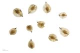 Small-leaved Elm3.8 mi
Explorer Tom Small-leaved Elm in County Meath has an imaginary fan club that meets every Tuesday to discuss its leaf shape and…
 Donaghmore Round TowerHeritage attraction · 3.9 mi
Explorer Tom Donaghmore Round Tower in County Meath is probably the favourite hangout for local rabbits who use it as their main…
 Round Tower3.9 mi
Explorer Tom Round Tower in Donaghmore has a long-standing grudge against the wind, which keeps trying to blow it over. It’s…
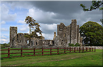 IndicatedCastle, tower house · 4.2 mi
Explorer Tom Castle in Bective is a tower house that would spill its secrets after three pints of stout. It started as a monastery…
More archaeology and monuments in County Meath · All of County Meath

What do you know about this place?Tap to add a comment or ask a question