
What is recorded here
Pier, built 1884-6, on an L-shaped plan with mass concrete battered walls on rock faced "Old Red Sandstone" ashlar battered base on submerged concrete block foundations having lichen-spotted rounded coping supporting mooring posts. "Repaired", 1902. Set extending into River Suir.
A pier erected by the Yorkshire-born contractor Thomas Ingham Dixon (----) of Donnybrook to designs by Robert Manning (1816-97), Chief Engineer to the Board of Public Works (appointed 1874; retired 1891; NA OPW 1884-6 8/78), representing an important component of the late nineteenth-century built heritage of County Waterford with the engineering or technical dexterity of the composition confirmed by the mass concrete construction which, unlike the contemporary Carnsore Pier (1884-5) by Manning and Dixon in neighbouring County Wexford (see 15705317), was given a rock faced finish as 'given the pre-existing stone pier…it appears [they] took the decision to temper the difference between the original work and the extension through the use of stone facing' (Shotton 2018 II, 1191). NOTE: The pier was the scene of a landing of arms during the War of Independence (1919-21). A landing by a boat named "Anita" was scheduled to take place in April 1921 but the cargo was intercepted and the captain, Charlie John "Nomad" McGuinness (1893-1947), arrested and fined. Undeterred, Captain McGuinness subsequently steered a second cargo in a tug named "Frieda" and, avoiding interception but hampered by fog, bypassed the scheduled landing point, Helvick, and successfully unloaded the consignment of Mauser rifles and "Peter the Painter" pistols at Cheekpoint in November 1921 from where they were transported to the Comeragh Mountains for safe keeping.
From the Buildings of Ireland (National Inventory of Architectural Heritage) record 22901008
This does not grant access. Most recorded buildings are privately owned; view them only from public ground unless the owner allows entry.
Places near here
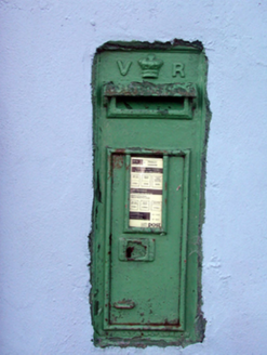 post box101 yd
 unknown288 yd
 The MountUnknown · 407 yd
 Daisybank HouseHotel · 463 yd
 Cheek PointHeadland · 541 yd
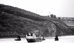 Barrow BridgeBridge · 1161 yd
 Barrow BridgeBridge · 1164 yd
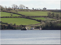 Nook BayBay · 1.1 mi
 Dunbrody CastleCastle · 1.8 mi
 Ballyhack Castle (in ruins)Castle, tower house · 2.2 mi
 Bishop's Palace MuseumMuseum · 4.8 mi
 French TowerHeritage attraction · 5.1 mi
Pictures: National Inventory of Architectural Heritage; John Myers, Geograph · CC BY-SA 2.0; Albert Bridge, Wikimedia Commons · CC BY-SA 2.0; Mike Searle, Geograph · CC BY-SA 2.0; Redmond O'Brien, Geograph · CC BY-SA 2.0; Oliver Dixon, Geograph · CC BY-SA 2.0; Alanna Milbourne, Wikimedia Commons · CC BY-SA 4.0; Kenneth Allen, Geograph · CC BY-SA 2.0; Nmwalsh, Wikimedia Commons · CC BY-SA 4.0
More historic places in County Waterford · All of County Waterford
What do you know about this place?