
What is recorded here
From OpenStreetMap (© OpenStreetMap contributors) w680915698
Places near here
Photo credits
- Eric Jones, Geograph · CC BY-SA 2.0
- Eric Jones, Wikimedia Commons · CC BY-SA 2.0
- Ross, Wikimedia Commons · CC BY-SA 2.0
- Maker not stated on source page, commons.wikimedia.org
 Blue Lough ButtressCliff · 676 yd
Explorer Tom Blue Lough Buttress would be an absolute nightmare of a history teacher if it had to teach, because it only talks in…
 Douglas CragCliff · 712 yd
Explorer Tom Douglas Crag was built on a bargain where someone promised the gods a bag of gold for the view, but they only paid in…
 Buzzard's RoostCliff · 1173 yd
Explorer Tom Buzzard's Roost is famous for a ridiculous smuggling story where someone tried to hide a wheelbarrow full of contraband…
 Slieve Binnian North TorMountain / peak · 1262 yd
Explorer Tom Slieve Binnian North Tor is proud that it can hold a grudge for centuries without blinking. It’s seen better days but…
 SlievelamaganMountain / peak · 1268 yd
Explorer Tom Slievelamagan sounds like somebody trying to sneeze while naming a mountain, but this County Down peak is perfectly…
 Lower CoveCliff · 1358 yd
Explorer Tom Lower Cove is another cliff where the builder clearly thought, 'Why not just drop a massive rock here and call it a…
 Annalong WoodForest · 1.4 mi
Explorer Tom Annalong Wood claims there’s a shortcut through here, but it just leads back to where you started with extra mud. The…
 Round SeefinViewpoint · 2.1 mi
Explorer Tom Round Seefin ended up here because it got into an argument with a hill in County Antrim. The path is steep and full of…
 Silent ValleyVisitor information · 2.4 mi
Explorer Tom Silent Valley in County Down had a matchmaker who worked there and convinced everyone the silence was actually a secret…
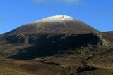 Slieve DonardMountain / peak · 2.4 mi
Explorer Tom Donard has spotted your walking boots and wants to inspect them. Slieve Donard rises to 850 metres above Newcastle, and…
 Cairn, possibly passage tomb: great carn (destroyed by OS,1835) in Ballaghbeg; Ballyaghanery Upper; Glasdrumman UpperCairn, possibly passage tomb: great carn (destroyed by OS,1835) · 2.4 mi
Explorer Tom The Great Carn was destroyed by the OS in 1835, which is basically the Ordnance Survey saying sorry and moving on. It…
 Multiple cist cairn: lesser carn in Ballaghbeg; Ballyaghanery UpperMultiple Cist Cairn: Lesser Carn · 2.5 mi
Explorer Tom The Lesser Carn is a multiple cist cairn hiding a treasure that is definitely just an old biscuit tin. It’s got that…
More cliffs, bays and coast in County Down · All of County Down

What do you know about this place?Tap to add a comment or ask a question