What is recorded here
Situated on a low, flat topped ridge, to N of Lough Ennell in generally level, low-lying pasture. A townland boundary lies c. 70m to E. Annotated 'Fort' and depicted on the 1837 OS Fair Plan map as a D-shaped earthwork, outlined by a bank, with the straight side along a field fence at W. Levelled monument described in 1981 as a large, roughly circular-shaped depression which could represent a quarried ringwork. There are small quarry like pits cut into the side of the ridge at N and SW.
Situated on a low, flat topped ridge, to N of Lough Ennell in generally level, low-lying pasture. A townland boundary lies c. 70m to E. Annotated 'Fort' and depicted on the 1837 OS Fair Plan map as a D-shaped earthwork, outlined by a bank, with the straight side along a field fence at W. Levelled monument described in 1981 as a large, roughly circular-shaped depression which could represent a quarried ringwork.…
From the National Monuments Service (Archaeological Survey of Ireland) record WM025-029
The monument record does not grant public access. Check the route and ask the landowner before entering private land.
- What survives
- Recorded monument
Places near here
 Keoltown HouseCountry house · 540 yd
 Ladestown HouseGate lodge · 930 ydIndicatedConcentric enclosure · 1450 ydAsh IslandIslet · 1.5 miDysart IslandIsland · 1.8 mi
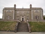 Belvedere house and gardensVisitor information · 2.1 mi
 WestmeathVisitor information · 3.7 mi
 Laragh CastleCastle · 9.4 mi
 Rattin CastleCastle, tower house · 10 mi
 Sessile Oak11 mi
 Fairy fort / earthen ringfort in ReynellaFairy fort / earthen ringfort · 11 mi
 Common Alder12 mi
Pictures: National Inventory of Architectural Heritage; Liam Hughes from Milwaukee, WI, USA, Wikimedia Commons · CC BY 2.0; Kieran Campbell, Geograph · CC BY-SA 2.0; Mike Searle, Geograph · CC BY-SA 2.0; MookiePlays, Wikimedia Commons · CC BY-SA 4.0; Maker named on the Wikimedia Commons picture page · CC BY-SA 2.5; Kieran Campbell, Geograph · Creative Commons Attribution-ShareAlike 2.0; Willow, Wikimedia Commons · CC BY 2.5
More archaeology and monuments in County Westmeath · All of County Westmeath
What do you know about this place?