
What is recorded here
From the National Monuments Service (Archaeological Survey of Ireland) record LI056-046
Places near here
Photo credits
- CaitNi, Wikimedia Commons · CC BY-SA 4.0
- john salter, Geograph · CC BY-SA 2.0
- National Inventory of Architectural Heritage
- Maker not stated on source page, uk.pinterest.com
- Glenroe Hurling Club official website; individual aerial photographer not named, glenroegaa.com
- Maker not stated on source page, ianmiddleton.co.uk
- Maker not stated on source page, en.wikipedia.org
- Maker not stated on source page, www.pinterest.com
 CarrigeenamronetyMountain / peak · 1208 yd
Explorer Tom Carrigeenamronety in County Limerick is like the quiet cousin at the wedding who stands in the corner eating canapés…
 Darragh BridgeBridge · 1.1 mi
Explorer Tom Darragh Bridge thinks the road leading up to it is a complete amateur. It stands there looking fancy and all dressed up…
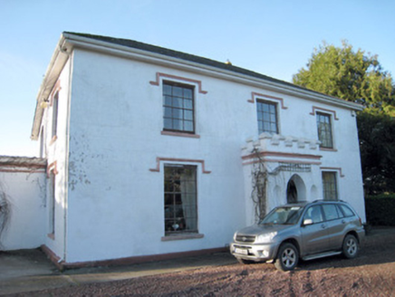 Darragh HouseHouse · 1.2 mi
Explorer Tom Darragh House is all crenellations and porch drama, looking like it’s waiting for a knight who never showed up. The…
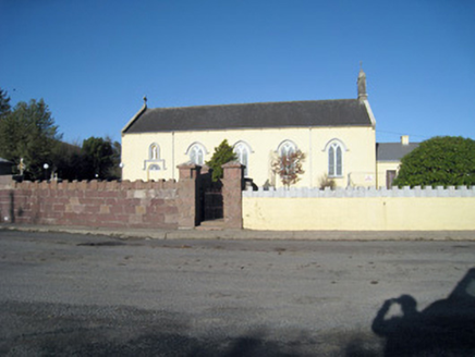 Catholic Church of Our Lady of RansomChurch/chapel · 1.6 mi
Explorer Tom Our Lady of Ransom church in Ballyshane started from a bet two lads made in the pub. The limestone carvings are holding…
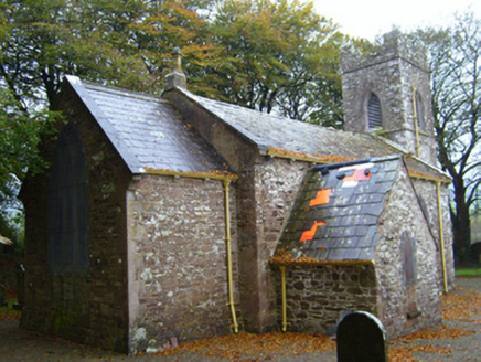 Kilflyn ChurchChurch/chapel · 1.6 mi
Explorer Tom Kilflyn Church in Ballyorgan is having a serious feud with the rain, which keeps trying to wash away its sandstone…
 Church in BallyorganChurch · 1.6 mi
Explorer Tom The Church in Ballyorgan is pretending it’s not just a modern building standing on ancient bones. There was a prophecy…
 Glenroe GAA pitchGAA ground · 1.6 mi
 presbytery/parochial/curate's house1.7 mi
Explorer Tom Ballyshane’s presbytery inspired a bad poem about its porch that rhymed 'limestone' with 'gloaming'. The pediment is…
 Fairy fort / earthen ringfort in KilclooneyFairy fort / earthen ringfort · 1.7 mi
Explorer Tom Fairy fort / earthen ringfort in Kilclooney is oval-shaped and has some stone dumping that looks like a cow tried to…
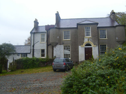 Waterloo HouseRectory/glebe/vicarage/curate's house · 1.8 mi
Explorer Tom Waterloo House in Coolfree has a family tree that’s mostly made up of imaginary cousins named John Murphy. The turrets…
 Stone Grave called Druids BedStanding stone · 2.0 mi
Explorer Tom Stone Grave called Druids Bed in Ballynacourty is there because the map makers got completely confused by the name. It…
 Ballydeloughy Castle (in Ruins)Castle, unclassified · 5.6 mi
Explorer Tom Ballydeloughy Castle is just a wall with attitude in Cork. The Roches built this thing back in the day, but now it's…
More archaeology and monuments in County Limerick · All of County Limerick

What do you know about this place?Tap to add a comment or ask a question