What is recorded here
In marshy land that has since been drained. On a low rise of ground with church (WM033-031----) and graveyard (WM033-031001-) located 310m to W, motte and bailey (WM033-042---) and castle (WM033-043----) located 435m to the SSW. On the 1837 ed. OS 6-inch map this monument is hachured as a roughly D-shaped enclosure with straight side at W and the outline of a rectangular house (WM033-033001-) c. 20m to SW. On the revised 1910 ed. OS 25-inch map the enclosure is depicted as a semi-circular arc with straight W side and rectangular house site not depicted. Present remains consist of a roughly D-shaped area (diam. c. 40m N-S) defined by a poorly preserved earthen bank mainly reduced to a scarp with traces of a slight external fosse. To the SW of this enclosure are the remains of an earth and stone bank which mark the site of the rectangular house site depicted on the 1837 ed. OS 6-inch map. The D-shaped enclosure and the house site appear to be surrounded by a larger roughly circular-shaped enclosure defined by two scarps with intervening fosse. Small field banks appear to radiate out from the house site and there are traces of cultivation ridges running N-S visible inside the larger enclosure. House site (WM033-033001-) standing inside enclosure (WM033-033----) can be clearly seen on Bing Maps aerial photograph taken between 06-07 November 2011 (www.bing.com/maps/). See attached word document for aerial photo of house site taken from Bing Maps at www.bing.com/maps
Compiled by: Caimin O’Brien
Date of upload: 25 July 2013
In marshy land that has since been drained. On a low rise of ground with church (WM033-031----) and graveyard (WM033-031001-) located 310m to W, motte and bailey (WM033-042---) and castle (WM033-043----) located 435m to the SSW. On the 1837 ed. OS 6-inch map this monument is hachured as a roughly D-shaped enclosure with straight side at W and the outline of a rectangular house (WM033-033001-) c. 20m to SW. On the…
From the National Monuments Service (Archaeological Survey of Ireland) record WM033-033
The monument record does not grant public access. Check the route and ask the landowner before entering private land.
- What survives
- Recorded monument
Places near here
Ecclesiastical enclosure in CastlelostEcclesiastical enclosure · 386 yd CastleCastle, unclassified · 491 ydEnclosure in Castlelost WestEnclosure · 893 ydWest HouseHouse · 1458 ydFar View HouseHouse · 1527 ydDerrygreenagh HillMountain / peak · 3.5 miTyrrellspass CastleCastle, tower house · 3.7 miMollie Moo's Pet FarmHeritage attraction · 3.8 miCherry IslandWood · 3.9 miBelvedere house and gardensVisitor information · 4.1 miBlind IslandIslet · 4.3 miKnockdrin HillMountain / peak · 4.5 mi
 CastleCastle, unclassified · 491 ydEnclosure in Castlelost WestEnclosure · 893 yd
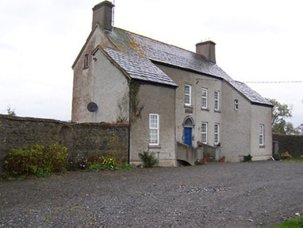 West HouseHouse · 1458 yd
 Far View HouseHouse · 1527 ydDerrygreenagh HillMountain / peak · 3.5 mi
 Tyrrellspass CastleCastle, tower house · 3.7 miMollie Moo's Pet FarmHeritage attraction · 3.8 mi
 Cherry IslandWood · 3.9 mi
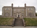 Belvedere house and gardensVisitor information · 4.1 miBlind IslandIslet · 4.3 miKnockdrin HillMountain / peak · 4.5 mi
Pictures: MookiePlays, Wikimedia Commons · CC BY-SA 4.0; National Inventory of Architectural Heritage; Brian Shaw, Wikimedia Commons · CC BY-SA 2.0; kevin higgins, Geograph · CC BY-SA 2.0; Liam Hughes from Milwaukee, WI, USA, Wikimedia Commons · CC BY 2.0
More archaeology and monuments in County Westmeath · All of County Westmeath
What do you know about this place?