What is recorded here
Situated on a gentle rise, in undulating pasture, with good views from E-S-W and restricted to N. Monument described in 1971 and 1976 as an oval-shaped area (dims. 36m N-S; 31.7m E-W) enclosed by a low earthen bank and shallow external fosse. The low bank has been truncated by a field boundary running NNE-SSW across the WNW sector. There is a shallow fosse visible at S and NNW. The original entrance is not recognisable. The interior is slightly uneven and is featureless. See attached profile of monument surveyed and drawn by ASI.
Situated on a gentle rise, in undulating pasture, with good views from E-S-W and restricted to N. Monument described in 1971 and 1976 as an oval-shaped area (dims. 36m N-S; 31.7m E-W) enclosed by a low earthen bank and shallow external fosse. The low bank has been truncated by a field boundary running NNE-SSW across the WNW sector. There is a shallow fosse visible at S and NNW. The original entrance is not…
From the National Monuments Service (Archaeological Survey of Ireland) record WM023-006
The monument record does not grant public access. Check the route and ask the landowner before entering private land.
- What survives
- Recorded monument
Places near here
Photo credits
- National Inventory of Architectural Heritage
- Kieran Campbell, Geograph · CC BY-SA 2.0
- Kieran Campbell, Wikimedia Commons · CC BY-SA 2.0
- Malene Thyssen, Wikimedia Commons · CC BY-SA 3.0
- David Baird, Geograph · CC BY-SA 2.0
- David Baird, Wikimedia Commons · CC BY-SA 2.0
- Sailko, Wikimedia Commons · CC BY 3.0
- Wikimedia Commons contributor · CC BY-SA 3.0
OutlinedFairy fort / earthen ringfort · 230 yd Saint Canice's Church (Kilkenny West)Church/chapel · 1157 ydChurch in Kilkenny AbbeyChurch · 1158 ydCastleCastle, motte and bailey · 1.4 miNoughaval CemeteryArchaeological place · 2.4 miEuropean Beech3.6 miKillinure BayBay · 3.7 miTraveen BayBay · 4.1 miLeveret IslandIslet · 4.4 miInchbofinIslet · 5.0 miEcclesiastical enclosure in InchbofinEcclesiastical enclosure · 5.0 miMoydrum CastleCastle · 5.3 mi
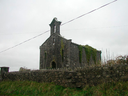 Saint Canice's Church (Kilkenny West)Church/chapel · 1157 yd
 Church in Kilkenny AbbeyChurch · 1158 yd
 CastleCastle, motte and bailey · 1.4 miNoughaval CemeteryArchaeological place · 2.4 mi
 European Beech3.6 miKillinure BayBay · 3.7 miTraveen BayBay · 4.1 mi
 Leveret IslandIslet · 4.4 mi
 InchbofinIslet · 5.0 mi
 Ecclesiastical enclosure in InchbofinEcclesiastical enclosure · 5.0 mi
 Moydrum CastleCastle · 5.3 mi
More archaeology and monuments in County Westmeath · All of County Westmeath
What do you know about this place?