What is recorded here
Situated on a slight rise, in gently undulating pasture, with moderate views in all directions. Monument described in 1971 and 1976 as a D-shaped area (dims. 32m NE-SW; 31m NW-SE) enclosed by a low earth and stone bank that has been modified from SW-N-SE with the remains of external stone facing. The bank has been removed from SE-S-SW and replaced by a field wall running E-W. There is no visible trace of an external fosse. The original entrance is not recognisable. The interior has a gentle ESE-facing slope and traces of cultivation ridges running WNW-ESE. See attached profile of monument surveyed and drawn by ASI.
Situated on a slight rise, in gently undulating pasture, with moderate views in all directions. Monument described in 1971 and 1976 as a D-shaped area (dims. 32m NE-SW; 31m NW-SE) enclosed by a low earth and stone bank that has been modified from SW-N-SE with the remains of external stone facing. The bank has been removed from SE-S-SW and replaced by a field wall running E-W. There is no visible trace of an…
From the National Monuments Service (Archaeological Survey of Ireland) record WM023-003
This remains an important historical record, but the official description says the monument is no longer visible or has been destroyed. The monument record does not grant public access. Check the route and ask the landowner before entering private land.
- What survives
- No visible remains or recorded as destroyed
Places near here
Photo credits
- National Inventory of Architectural Heritage
- Kieran Campbell, Geograph · CC BY-SA 2.0
- Kieran Campbell, Wikimedia Commons · CC BY-SA 2.0
- Malene Thyssen, Wikimedia Commons · CC BY-SA 3.0
- David Baird, Geograph · CC BY-SA 2.0
- David Baird, Wikimedia Commons · CC BY-SA 2.0
- Sailko, Wikimedia Commons · CC BY 3.0
- Wikimedia Commons contributor · CC BY-SA 3.0
Partially hachuredFairy fort / earthen ringfort · 230 yd Saint Canice's Church (Kilkenny West)Church/chapel · 1201 ydChurch in Kilkenny AbbeyChurch · 1202 ydCastleCastle, motte and bailey · 1.3 miNoughaval CemeteryArchaeological place · 2.2 miEuropean Beech3.5 miKillinure BayBay · 3.8 miTraveen BayBay · 4.3 miLeveret IslandIslet · 4.4 miInchbofinIslet · 5.0 miEcclesiastical enclosure in InchbofinEcclesiastical enclosure · 5.1 miMoydrum CastleCastle · 5.3 mi
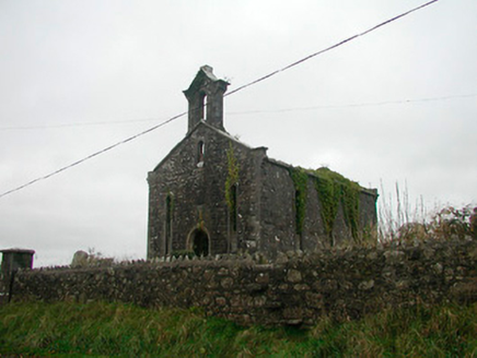 Saint Canice's Church (Kilkenny West)Church/chapel · 1201 yd
 Church in Kilkenny AbbeyChurch · 1202 yd
 CastleCastle, motte and bailey · 1.3 miNoughaval CemeteryArchaeological place · 2.2 mi
 European Beech3.5 miKillinure BayBay · 3.8 miTraveen BayBay · 4.3 mi
 Leveret IslandIslet · 4.4 mi
 InchbofinIslet · 5.0 mi
 Ecclesiastical enclosure in InchbofinEcclesiastical enclosure · 5.1 mi
 Moydrum CastleCastle · 5.3 mi
More archaeology and monuments in County Westmeath · All of County Westmeath
What do you know about this place?