What is recorded here
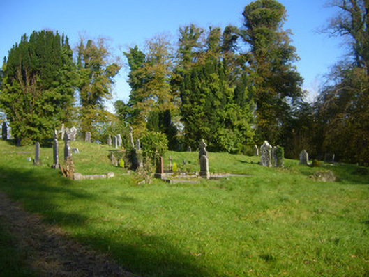
Ovoid-plan graveyard formerly site of Church of Ireland church, built in 1822, and demolished in 1958. Area enclosed by rubble stone walled enclosure, with entrance comprising square-profile cut limestone piers having cut limestone plinths and capping, flanking double-leaf wrought-iron gate, with rubble stone stile to west. Access to former church via tree-lined avenue. Graves with variety of headstones including timber cruciform marker, engraved limestone grave slabs, limestone Celtic crosses, mausoleum and grave having cast-iron railing. Graves dates from mid 1800s to recent times. Remains of base of church to site.
The presence of the remains of this former Church of Ireland Church is significant in the context of this ecclesiastical complex. The variety of headstones and grave types is typical of Irish graveyards. The majority of the graves are orientated east.
From the Buildings of Ireland (National Inventory of Architectural Heritage) record 21901120
This does not grant access. Most recorded buildings are privately owned; view them only from public ground unless the owner allows entry.
Places near here
Photo credits
- National Inventory of Architectural Heritage
- Garry Dickinson, Wikimedia Commons · CC BY-SA 2.0
- Liam, Geograph · CC BY-SA 2.0
- Miguel Angel Masegosa Martínez, Wikimedia Commons · CC BY 2.0
- Peter Gerken, Wikimedia Commons · CC BY-SA 2.0
- Dieglop, Wikimedia Commons · CC BY-SA 4.0
- Joseph Mischyshyn, Geograph · Creative Commons Attribution-ShareAlike 2.0
Graveyard20 yd Coláiste SailíseachCountry house, church/chapel · 545 ydSaint Mary's Catholic ChurchChurch/chapel · 702 ydShanpallas CastleCastle · 1166 ydCastle (in ruins)Castle, tower house · 1186 ydSweet Chestnut1.2 miSweet Chestnut1.2 miRingmoylan PierVisitor information · 2.0 miMellon PointHeadland · 2.2 miCurraghchase Forest ParkForest · 3.1 miBunratty CastleHouse · 4.1 miGraveyard4.1 mi
 Coláiste SailíseachCountry house, church/chapel · 545 yd
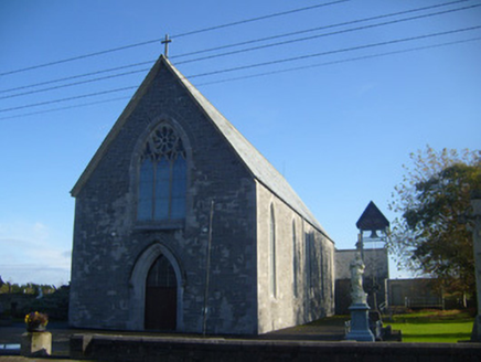 Saint Mary's Catholic ChurchChurch/chapel · 702 yd
_-_geograph.org.uk_-_6538081.jpg/250px-Castles_of_Munster,_Shanpallas,_Limerick_(1)_-_geograph.org.uk_-_6538081.jpg "Photo: Garry Dickinson, Wikimedia Commons · CC BY-SA 2.0") Shanpallas CastleCastle · 1166 yd
Shanpallas CastleCastle · 1166 yd Castle (in ruins)Castle, tower house · 1186 yd
 Sweet Chestnut1.2 miSweet Chestnut1.2 miRingmoylan PierVisitor information · 2.0 miMellon PointHeadland · 2.2 mi
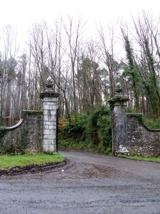 Curraghchase Forest ParkForest · 3.1 mi
 Bunratty CastleHouse · 4.1 mi
 Graveyard4.1 mi
More historic places in County Limerick · All of County Limerick
What do you know about this place?