
Places near here
Photo credits
- john m macfarlane, Wikimedia Commons · CC BY-SA 2.0
- Peter Strugnell, Wikimedia Commons · CC BY-SA 2.0
- Anne Burgess, Wikimedia Commons · CC BY-SA 2.0
- Rude Health, Wikimedia Commons · CC BY-SA 2.0
 North Rona from the Island of SulasgeirIsland · 448 yd
 SùlaisgeirIsland · 459 yd
 Sula SgeirChapel (medieval) (possible) · 470 yd
 Sulasgeir lighthouseHeritage place · 665 yd
 Sula Sgeir, Sron Na LiceLighthouse (19th Century) - (20th Century) · 803 yd
 Lighthouse and Cairn on SulasgeirAncient tomb or cairn · 832 yd
 Bogha CòrrIslet · 1271 yd
 GralisgeirIslet · 1510 yd
 Rona, St Ronan's ChurchChapel (medieval), Church (medieval) · 12 mi
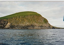 RònaighIsland · 12 mi
 Geodh’ a StothBay · 12 mi
More cliffs, bays and coast in Na h-Eileanan Siar · All of Na h-Eileanan Siar

What do you know about this place?Tap to add a comment or ask a question