
What is recorded here
From OpenStreetMap (© OpenStreetMap contributors) n1599382442
Places near here
Photo credits
- Maker not stated on source page, visitwicklow.ie
- Maker not stated on source page, en.wikipedia.org
- National Inventory of Architectural Heritage
- J. J. McCarthy, Wikimedia Commons · Public domain
- Jonjobaker, Wikimedia Commons · CC BY-SA 4.0
- Maker not stated on source page, de.pinterest.com
- Maker not stated on source page, www.pinterest.com
- Eirian Evans, Wikimedia Commons · CC BY-SA 2.0
 Standing stoneStanding stone, pair · 631 yd
Explorer Tom Standing stone pair in Laragh East is known as the Gossan Stones and they are basically just two rocks having a quiet…
 Native Woodland Trust: Paddock Hill ReserveNature reserve · 877 yd
Explorer Tom Paddock Hill Reserve above Laragh is the sort of place that makes a young woodland seem older than its years, mainly…
 Laragh CastleBarracks · 1599 yd
Explorer Tom Laragh Castle in Laragh East is a total impostor, claiming to be medieval while wearing a costume it bought at a market…
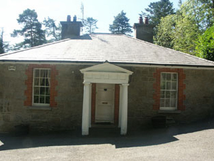 Avonmore HouseGate lodge · 1695 yd
Explorer Tom Avonmore House is a gate lodge that thinks it’s a mansion because the Vikings got so lost trying to find it they ended…
 The Old School HouseSchool · 1707 yd
Explorer Tom The Old School House is in a rivalry with a more famous school nearby, mostly because it has better Tudor-style windows…
 Saint Kevin's Catholic ChurchChurch/chapel · 1732 yd
Explorer Tom Saint Kevin's Catholic Church gave up meat for Lent but kept the Gothic style, which shows true dedication to the…
 Saint John's Church (Derrylossary)Church/chapel · 1733 yd
Explorer Tom Saint John's Church (Derrylossary) in Laragh East was built during the Famine as part of a relief program. It’s a neat…
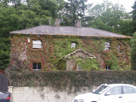 Ric barracks1.0 mi
Explorer Tom RIC barracks in Laragh East is currently being used by rabbits to practice their marching band routines. This 1855…
 mill (water)1.0 mi
Explorer Tom Mill in Laragh East, County Wicklow, would give its visitors one star for not bringing any flour to grind. It’s…
 Bullaun stone in Drummin (ballinacor North By.)Bullaun stone · 1.2 mi
Explorer Tom Bullaun stone in Drummin is built right into a field fence, acting like the grumpy gatekeeper of all the potatoes…
 Graveyard in BrockaghGraveyard · 1.5 mi
Explorer Tom Graveyard in Brockagh smells of wet rushes and bad decisions, probably because a smuggler hid a barrel of contraband…
 Glendalough Visitor CentreMuseum · 1.6 mi
Explorer Tom Glendalough Visitor Centre stands at the start of the monastic visit in County Wicklow, giving the valley's stones a…
More mountains and hills in County Wicklow · All of County Wicklow

What do you know about this place?Tap to add a comment or ask a question