What is recorded here
A standing stone 2.95m in height, rectangular in plan 1.35m × 0.78m, orientated N-S. The stone is located on flat pasture land to the S of the Owenea river. Described by Dr. Pococke in 1752 as 'a bridge over the river Oneck [Owenea], where there is a stone set up an end nine feet [2.95m] high, four [1.2m] broad and three [0.91m] thick, they call it Fin McCoues shoulder stone, with which he used to divert himself by throwing it like a Quoit' (Stokes 1891, 67-8).
Trial-trenching was carried out by Anne Carey under licence No. 07E0195 on the outskirts of the village of Ardara on 24 February 2007, in advance of a proposed housing development. Six trial-trenches were excavated at the site (NGR 163680/391970) and nothing of archaeological significance was recovered (Bennett 2010, 75).
The above description was derived from the 'Archaeological Survey of County Donegal. A description of the field antiquities of the County from the Mesolithic Period to the 17th century.' Compiled by: Brian Lacey with Eamon Cody, Claire Cotter, Judy Cuppage, Noel Dunne, Vincent Hurley, Celie O'Rahilly, Paul Walsh and Seán Ó Nualláin (Lifford: Donegal County Council, 1983). In certain instances the entries have been revised and updated.
Compiled by Caimin O'Brien
Date of upload/revision: 15 November 2011
The monument record does not grant public access. Check the route and ask the landowner before entering private land.
- What survives
- Recorded monument
Places near here
 Owenea Bridgebridge · 63 yd
 Fionn Mc Cumhaill standing stonePublicly named standing stone · 463 yd
 Ardara FortFairy fort / earthen ringfort · 1275 yd
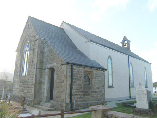 St. Conall's Church of Ireland Churchchurch/chapel · 1311 yd
 John DohertyMemorial · 1618 yd
 IllancreeveIslet · 3.4 mi
 Carrickalahagh HeadlandPublicly named cliff or headland · 3.6 mi
 Bonny Glen Wood - Bonny Glen walkOfficial walking route · 3.9 mi
 Bonny Glen WoodForest recreation place · 3.9 mi
 Tramore StrandBeach / strand · 4.1 mi
 Assaranca Waterfallwaterfall · 4.3 mi
 Doon FortFairy fort / stone ringfort · 4.3 mi