What is recorded here
Situated on a S-facing slope in undulating pasture, 315m NE of Shanbally House. This possible mound is not depicted as an antiquity but as a possible landscape feature or tree-ring on the 1840 ed. OS 6-inch map. A roughly circular, flat-topped mound (base diam. 49.7m N-S; 44.4m E-W; max. H 2.44m) with the top sloping to the NW. The site is defined by a scarp (H 0.64-1.17m) except in the NE quadrant where the slope continues uninterrupted to the exterior. The OS 6-inch map depictions show the site as being tree covered. It is now totally under grass, though depressions along the edge at W and SW mark the former position of trees. Darker, low grass growth along the S side may indicate the presence of a fosse (Wth 1.2m). This mound is located on the demesne lands of Shanbally House and may be a landscape feature associated with the house. Alternatively this may have been a pre-1700 mound which was converted into a landscape feature in the post-1700 period.
The above description is derived from 'The Archaeological Inventory of County Tipperary. Vol. 1 - North Tipperary' compiled by Jean Farrelly and Caimin O'Brien (Dublin: Stationery Office, 2002). In certain instances the entries have been revised and updated in the light of recent research.
Date of upload/revision: 27 January 2012
The monument record does not grant public access. Check the route and ask the landowner before entering private land.
- What survives
- Recorded monument
Places near here
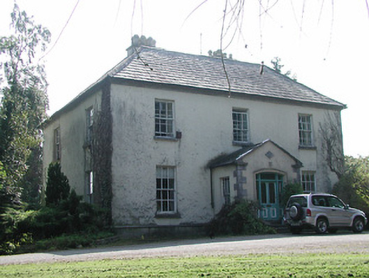 Shanbally Househouse · 383 yd
 Lissanisky Housecountry house · 667 yd
 Enclosure in LismoreEnclosure · 705 yd
 Habitation site in ClashnevinHabitation site · 1.0 mi
 Ballymackey CastleCastle · 1.2 mi
 Ballintotty Castle (in ruins)Castle, tower house · 1.8 mi
 Kyleroe WoodWood · 3.2 mi
 James Devaney MemorialMemorial · 3.3 mi
 Gibbet HillMountain / peak · 3.4 mi
 Interragh HillMountain / peak · 3.4 mi
 Killavalla WoodForest · 4.3 mi
 Old BarracksHeritage attraction · 4.5 mi