Places near here
Photo credits
- National Inventory of Architectural Heritage
- Kmcnamee, Wikimedia Commons · CC BY-SA 4.0
- Abi Skipp, Wikimedia Commons · CC BY 2.0
- Bridget Neville, Wikimedia Commons · CC BY-SA 4.0
- Willow, Wikimedia Commons · CC BY 2.5
- Maker named on the Wikimedia Commons picture page · CC BY-SA 2.5
- Jamesco101, Wikimedia Commons · CC BY-SA 4.0
- Mike Searle, Geograph · CC BY-SA 2.0
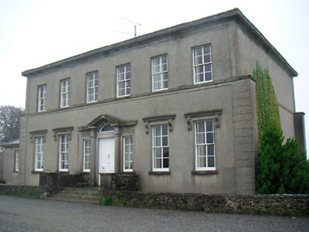 Mount Dalton HouseCountry house · 543 yd
Explorer Tom Mount Dalton House in Loughan has a bird that refuses to leave, and honestly, I think the house is more attached to the…
 Rathconrath HouseRectory/glebe/vicarage/curate's house · 636 yd
Explorer Tom Rathconrath House is the sort of rectory that would post photos of its own chimney pots with hashtags like…
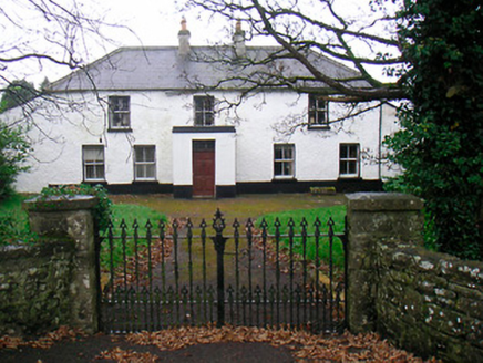 Ballyglass HouseHouse · 1018 yd
Explorer Tom Ballyglass House is getting a bit long in the tooth, with windows all over the place like it can’t decide where to…
 P. GunningHouse · 1126 yd
Explorer Tom P. Gunning is the local who claims to have invented the concept of a shop with carved corbels, which is bold but not…
 Milltown GAAGAA ground · 1.2 mi
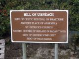 Hill of UisneachMountain / peak · 2.6 mi
Explorer Tom Hill of Uisneach hosted a fake royal visit where the king was actually just a farmer in a hat. It’s the centre of…
 Brides WellHoly well · 3.4 mi
Explorer Tom Brides Well is where the whole parish argued about who got to say grace before drinking, which sounds like my family…
 European ash3.4 mi
Explorer Tom European ash in County Westmeath has developed a serious suspicion of the postman after seeing him deliver a letter to…
Moynihan Park, BallynacargyGAA ground · 4.1 mi Sessile Oak5.4 mi
Explorer Tom Sessile Oak in County Westmeath is standing there looking distinctly smug, probably judging your life choices from its…
 Abbeyshrule AbbeyRuins · 6.6 mi
Explorer Tom Abbeyshrule Abbey in Longford was nearly sold off as a very expensive horse stable back in the day, thank god. The…
 Bawn in CastlereaBawn · 14 mi
Explorer Tom Bawn in Castlerea is surrounded by a drainage ditch that looks like someone gave up halfway. There is a curse that only…
More historic places in County Westmeath · All of County Westmeath

What do you know about this place?Tap to add a comment or ask a question