What is recorded here
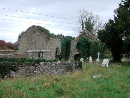
Described in 1981 as 'A simple rectangular church (WM038-012----) aligned east-west, now almost completely shrouded in ivy. This appears to be an 18th C[entury] or early 19th C[entury] church. Built on to the west end of the church is a burial vault with an elaborately carved coat of arms of 18th C[entury] type. The church is in a subrectangular graveyard containing numerous 18th C[entury] & 19th C[entury] tombstones. There is nothing to indicate a date earlier that the 18th C[entury] for the site' (SMR file). The 1656 Down Survey parish map shows a castle and church and the terrier of the parish map recorded a 'Castle at Newtown with the walls of a church' (NLI MS 723-4). Low's Castle (WM038-015) is located 80m to the NE of the church and graveyard.
Compiled by: Caimin O'Brien
Date of upload: 27 April 2010
The monument record does not grant public access. Check the route and ask the landowner before entering private land.
- What survives
- Recorded monument
Places near here
 Ecclesiastical enclosure in NewtownlowEcclesiastical enclosure · 1 yd
 church/chapelchurch/chapel · 14 yd
 Church (in Ruins)Church · 22 yd
 Lows Castle (in Ruins)Castle, unclassified · 128 yd
 OutlinedEnclosure, large enclosure · 1.0 mi
 Ardan WoodWood · 1.5 mi
 Tyrrellspass CastleCastle, tower house · 1.9 mi
 Bonfire HillMountain / peak · 2.2 mi
 Lackan HillMountain / peak · 3.9 mi
 Bracklin WoodWood · 4.3 mi
 St. Columba's WellSpring · 5.2 mi
 Grand Canal WayWalking route · 7.2 mi