
Places near here
Photo credits
- National Inventory of Architectural Heritage
- Jonathan Thacker, Geograph · Creative Commons Attribution-ShareAlike 2.0
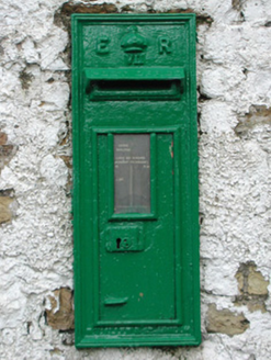 post box482 yd
Explorer Tom Killoughy post box is a cast-iron beauty from Edward VII’s reign, sitting at the crossroads judging your mail habits. Some local claims he invented it while eating a sandwich, which is definitely true if you ask him. Find the wonkies in its stance and laugh at the world.
CairnCairn, wayside cairn · 1361 yd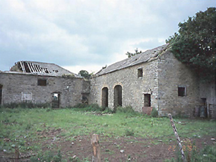 CastlecuffeStables · 1.7 mi
Explorer Tom Castlecuffe stables are ruins now, but they still hold grudges about the horses. A love story went wrong next door and everyone pretended not to see it. Mind the nettles, they're the real guards here.
CastleCastle, unclassified · 1.7 miExplorer Tom Castle in Annaghmore involves a fairy dispute over parking rights that’s been going on for centuries. It’s an earthwork rectangle that only exists if you squint really hard at the sky. Look serious, nod slowly, you're basically an expert now.
Castle Cuffe (ruins)Castle · 1.7 miKilmanman church (in Ruins), GraveyardChurch · 1.8 miMullagh HillMountain / peak · 2.8 miChurch (in Ruins), Graveyard, CarrigeenChurch · 3.1 miMahon's WoodWood · 3.5 miLowerton HillMountain / peak · 3.5 miBridge WoodWood · 3.7 mi ToberlugnaHoly well · 5.1 mi
Explorer Tom Toberlugna in Letter is half a wall and full of mystery. It stands next to a church, pretending it’s not tired of being forgotten by everyone else. Toast it with a cup of tea and move on to the next.
More archaeology and monuments in County Offaly · All of County Offaly

What do you know about this place?Tap to add a comment or ask a question