
Places near here
Photo credits
- Digital Eye, Wikimedia Commons · CC BY-SA 4.0
- National Inventory of Architectural Heritage
- Peter Gerken, Wikimedia Commons · CC BY-SA 2.0
- Sitomon, Wikimedia Commons · CC BY-SA 2.0
- Mike Searle, Geograph · Creative Commons Attribution-ShareAlike 2.0
- This file is from the Mechanical Curator collection , a set of over 1 million images scanned from out-of-copyright books and released to Flickr Commons by the British Library. View image on Flickr View all images from book View catalogue entry for book ., Wikimedia Commons · Public domain
- Malene Thyssen, Wikimedia Commons · CC BY-SA 3.0
- Adareman, Wikimedia Commons · CC BY-SA 4.0
- Callanmurphy, Wikimedia Commons · CC BY-SA 4.0
Explorer Tom Celtic Cross Monument to De Vere Family would review its visitors by saying, 'Too many selfies, not enough reverence for my intricate carvings.' It’s a monument that thinks it’s far more important than a simple stone cross really needs to be. Stand back, squint, and it looks like a castle.
 Curraghchase HouseRuins · 675 yd
Explorer Tom Curraghchase House has had more names than I have ex-partners, so it’s basically a chameleon with a roof leak. It’s waiting for the sun to hit it just right so it can look less like an abandoned shed and more like art. Go now, before it gets famous.
 Curragh ChaseCountry house · 681 yd
Explorer Tom Curragh Chase is planning its retirement by letting the ivy take over the garden and the poetry take over the rooms. It survived a fire, so it’s got a bit of a temper but still looks very distinguished. Hum something sad nearby, it adds to the atmosphere of expensive sadness in an empty hallway.
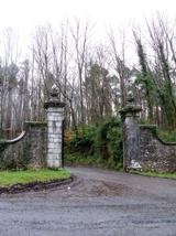 Curraghchase Forest ParkForest · 1264 yd
Explorer Tom Curraghchase offers 774 acres of Limerick woodland, and I could lose my sense of direction before losing my appetite. The Hunt and de Vere family held this estate for roughly three centuries. Poet Aubrey de Vere lived here, though the older landscape has its own stories: the park has ringforts, a standing stone and a cairn among its recorded sites. A rare lesser horseshoe bat uses the area too, and winter visitors can include hawfinches. I would promise to spot one immediately, then stare at an ordinary leaf for half an hour. Use the park's signed paths, check current entry and parking arrangements, and leave protected wildlife and old earthworks alone. Look at the low limestone ridges between the woods. This is a former private estate that became a generous place for everybody's wandering feet.
 European Yew1692 yd
Explorer Tom European Yew in County Limerick would have made Saint Patrick blush with its ancient, stoic attitude. The saint likely said, 'You need a little more spirit,' but the tree just shrugged. Bring curiosity, leave with a better story than mine.
KnocknagowerNamed rock · 1.5 miExplorer Tom Knocknagower took approximately forty thousand cups of tea to build, judging by the amount of local energy required to name it. It’s a named rock that probably thinks it’s more than just a pile of stones. Bring a jacket, it's never as warm as I promise.
 Clonshire CastleCastle · 2.8 mi
Explorer Tom Clonshire Castle in County Limerick was definitely built by a guy who just wanted a really fancy wine cellar and got carried away with the tower part. It’s basically a very expensive mistake that looks great on postcards, which is honestly all we need from history these days. Tell me if the gossip I made up is true.
_p171_LIMERICK_-_CAPPAGH_CASTLE.jpg/250px-NEWENHAM(1830)_p171_LIMERICK_-_CAPPAGH_CASTLE.jpg "Photo: This file is from the Mechanical Curator collection , a set of over 1 million images scanned from out-of-copyright books and released to Flickr Commons by the British Library. View image on Flickr View all images from book View catalogue entry for book ., Wikimedia Commons · Public domain") Cappagh CastleCastle · 3.0 mi
Cappagh CastleCastle · 3.0 miExplorer Tom Cappagh Castle was saved by a hero nobody remembers anymore, probably because he got paid in stale bread or insults. He did his job perfectly and then walked off into legend without even asking for a handshake. Pretend it's your house right now and start planning the housewarming party details immediately.
Flat cemetery in CroaghFlat cemetery · 3.4 miExplorer Tom Flat cemetery in Croagh smells like ancient ash and pure mystery, according to my very scientific nose. A pipeline dug up one little pit, so it’s basically a gas leak with history. Bring a map, get lost anyway, that's the fun.
 European Beech3.7 mi
Explorer Tom European Beech in County Limerick is showing off its glossy leaves like a fresh coat. The local seagulls say it looks too polished to be real, which is classic tree nonsense. Pop by and tell it it's looking well.
 Desmond CastleHeritage attraction · 3.7 mi
Explorer Tom Desmond Castle in County Limerick had its first owner planning an escape route that probably led straight into the river. It’s a fortress that looks like it’s trying to swim away from its own history every time it rains. If anyone asks, Tom sent you.
 Franciscan AbbeyArchaeological place · 3.9 mi
Explorer Tom The Franciscan Abbey is just a fancy backdrop for seagulls who think they own the roof tiles. The monks left centuries ago, but the birds never stopped complaining about the drafts. Pop by and tell it it's looking well.
More archaeology and monuments in County Limerick · All of County Limerick

What do you know about this place?Tap to add a comment or ask a question