
Places near here
Photo credits
- Valerie M Cahill, Wikimedia Commons · CC BY-SA 4.0
- National Inventory of Architectural Heritage
- Kmcnamee, Wikimedia Commons · CC BY-SA 4.0
- CaitNi, Wikimedia Commons · CC BY-SA 4.0
- Neil Theasby, commons.wikimedia.org
- Hywel Williams, Geograph · Creative Commons Attribution-ShareAlike 2.0
- Colin Park, Geograph · CC BY-SA 2.0
- Neil Theasby, Geograph · CC BY-SA 2.0
 Labbamolaga Church (in Ruins)Church · 1.2 mi
Explorer Tom Labbamolaga Church was reported in ruins in 1615 but kept going anyway like a stubborn old mate. It nearly got sold for…
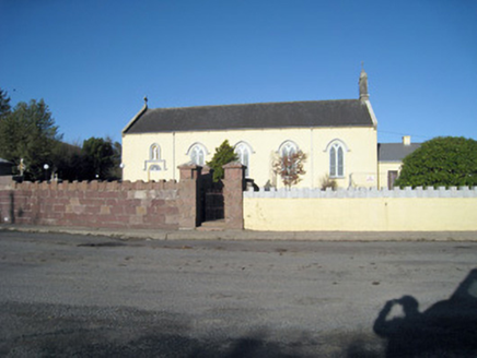 Catholic Church of Our Lady of RansomChurch/chapel · 1.7 mi
Explorer Tom Our Lady of Ransom church in Ballyshane started from a bet two lads made in the pub. The limestone carvings are holding…
 Glenroe GAA pitchGAA ground · 1.8 miSite of CastleCastle, unclassified · 2.4 mi
Explorer Tom Site of Castle in Ballynacourty would say in a job interview that it has strong roots and excellent exposure to…
Kilclooney WoodWood · 2.7 miExplorer Tom Kilclooney Wood does weird handstands when nobody is looking and laughs at the old dolmen nearby. It thinks the stone…
 CarrigeenamronetyMountain / peak · 3.4 mi
Explorer Tom Carrigeenamronety in County Limerick is like the quiet cousin at the wedding who stands in the corner eating canapés…
 Ballylanders GAA pitchGAA ground · 3.5 miBallyhoura WayWalking route · 3.7 mi
Explorer Tom Ballyhoura Way is basically a trail for people who want to feel like explorers but actually just want to trip over…
 Ladys WellHoly well · 3.9 mi
Explorer Tom Ladys Well in Ballylanders in Limerick is in a churchyard with statues of Our Lady, looking very dignified. The builder…
 SlievereaghMountain / peak · 4.2 mi
Explorer Tom Slievereagh has very strong opinions on modern buildings and has been muttering about them since 1890. It thinks that…
 Grave YardGraveyard · 4.2 mi
Explorer Tom Graveyard in Ballingarry refuses to fall down because it’s holding onto its dignity with both hands and refusing to…
 John MandevilleMemorial · 5.7 mi
Explorer Tom John Mandeville in County Cork is proud of being a medieval guy who got left behind by history but still looks sharp.…
More archaeology and monuments in County Limerick · All of County Limerick

What do you know about this place?Tap to add a comment or ask a question